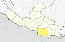
Hardauna
हर्दौना | |
|---|---|
Village | |
| Nepal🇳🇵 | |
| Zone | Lumbini Zone |
| District | Kapilvastu District |
| Government | |
| • Type | Local Government |
| • Chairperson | Shailendra Kumar Chaudhary |
| Population (2011) | |
| • Total | 4,841 |
| Time zone | UTC+5:45 (Nepal Time) |
| Area code | 40655 |
Hardauna is a village in the sub-metropolitan municipality of Maharajganj [1] in the Kapilvastu District of the Lumbini Province.[2] The village is in a terai region in southern Nepal.[3] It is on the Banganga, a river which arises on the southern slopes of the Sivalik Hills and flows across the Terai, reaching into Uttar Pradesh state in India.[4][5]
At the time of the 1991 Nepal census Hardauna had a population of 3,393 people living in 576 individual households.[6] In 2011, the census of the village counted a total population of 4,841 individuals (2,324 female and 2,517 male), residing in 676 separate household.[7]
Formerly, Hardauna was a village development committee (VDC), which were local-level administrative units. In 2017, the government of Nepal restructured local government in line with the new 2015 constitution and VDCs were discontinued.[8]
History
References
- ↑ Government of Nepal. "स्थानीय तहको वेवसाईटको विवरण" [Detail map of local level GIS]. sthaniya.gov.np (in Nepali). Retrieved 23 September 2021.
- ↑ Udhyami, Bikas. "New local level map of Nepal". nepalindata.com. Retrieved 23 September 2021.
- ↑ Guneratne, Arjun (2018). Many Tongues, One People: The Making of Tharu Identity in Nepal. Ithaca, NY: Cornell University Press. pp. 54–61. ISBN 9780801439124.
- ↑ National Planning Commission; Central Bureau of Statistics. "Major Rivers" (in Nepali). Government of Nepal. Hydrology Network of Nepal
- ↑ Dhungel, Dwarika Nath; Pun, Santa Bahadur; Adhikari, Basistha Raj (2009). "Inundation at the Southern Border". In Dhungel, Dwarika Nath; Pun, Santa Bahadur (eds.). The Nepal–India Water Relationship: Challenges. Springer. pp. 269–293. doi:10.1007/978-1-4020-8403-4_10. ISBN 978-1-4020-8403-4.
- ↑ "Nepal Census 2001". Nepal's Village Development Committees. Digital Himalaya. Retrieved 14 December 2008.
- ↑ Central Bureau of Statistics; National Planning Commission (November 2012). "National Population and Housing Census 2011". Census Nepal 2011. Kathmandu, Nepal: (censusnepal.cbs.gov.np) Government of Nepal. p. 79. Retrieved 26 September 2021.
- ↑ "New local level structure comes into effect from today". www.thehimalayantimes.com. The Himalayan Times. 10 March 2017.
27°29′N 82°57′E / 27.483°N 82.950°E
