| Harescombe | |
|---|---|
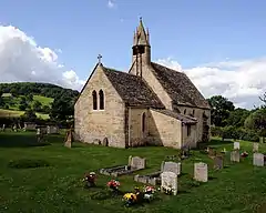
 The Church of St. John the Baptist | |
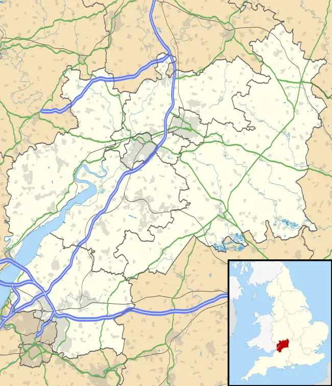
 Harescombe Location within Gloucestershire | |
| Population | 247 (2011)[1] |
| OS grid reference | SO8310 |
| Civil parish |
|
| District | |
| Shire county | |
| Region | |
| Country | England |
| Sovereign state | United Kingdom |
| Post town | Gloucester |
| Postcode district | GL6 6 |
| Dialling code | 01452 |
| Police | Gloucestershire |
| Fire | Gloucestershire |
| Ambulance | South Western |
| UK Parliament | |
Harescombe is a small village in Gloucestershire, England.[2] It is situated 5 miles (8 km) south of Gloucester. It is thought the name of the village is derived from a combination of the Celtic term "cwm" (valley) and the Saxon term "here" (army), thus the full meaning of "Harescombe" would be "the Army's Valley".[3]
The community is indeed in a valley as it rests at the foot of the well-known range of the Cotswolds called the Haresfield Beacon and Broadbarrow Green, which were sites of ancient British and Roman encampments. These encampments were a part of a chain of fortresses expressly mentioned by Tacitus as having been raised by Ostorius Scapula between the Severn and Avon Rivers: old British works adapted by the Romans to their own requirements.[3]
Hilles House was designed by Detmar Blow. He built the mansion for himself after 1914,[4][5]
The Church of St. John the Baptist
The Church of St. John the Baptist in Harescombe was constructed in the 13th century. It was consecrated in 1315. The walls are ashlar limestone, and the roof is of stone slate. The church has an unusual bellcote and a small octagonal stone spire, as well as small octagonal pinnacles on the four sides. Small iron crosses were added to these pinnacles in 1870–71 when Francis Niblett restored the church.[6] The belfry has two bells, one of which has been determined to be the oldest bell (circa 1180) in Gloucestershire.[7]
Several of the memorial inscriptions on markers in the adjacent graveyard date from the 17th century, with the oldest being for Thomas Roberts, Gent., dated 20 January 1632.[8]
The Church of St. John the Baptist is a grade 2* listed building with English heritage.[9]
References
- ↑ "Parish population 2011". Archived from the original on 4 March 2016. Retrieved 31 March 2015.
- ↑ Welbore St. Clair Baddeley (1913). Place-names of Gloucestershire: a handbook. J. Bellows. p. 78. Retrieved 24 June 2011.
- 1 2 Melland Hall, Rev. J. (1885). Transactions – Bristol and Gloucestershire Archaeological Society. Bristol: C. T. Jeffries and Sons. pp. 67–132.
- ↑ Musson, Jeremy (2018). Secret Houses of the Cotswolds. Frances Lincoln. pp. 70–75. ISBN 978-0711239241.
- ↑ "Hilles House and terraced gardens". National Heritage List for England. Historic England. Archived from the original on 14 March 2016. Retrieved 6 September 2020.
- ↑ Verey, David (1979). Gloucestershire: The Cotswolds. Penguin. ISBN 0-14-071040-X.
- ↑ "The Beacon Benefice". Archived from the original on 13 November 2011. Retrieved 29 June 2011.
- ↑ Blacker, Rev. Beaver H (1881). Gloucestershire Notes and Queries. London: Simpkin, Marshall, Hamilton, Kent, and Co., Ltd.
- ↑ "Listed Buildings in Stroud" (PDF). Archived from the original (PDF) on 16 December 2011. Retrieved 29 June 2011.
External links
![]() Media related to Harescombe at Wikimedia Commons
Media related to Harescombe at Wikimedia Commons