| Harper's Brook | |
|---|---|
 Harper's Brook at Lowick | |
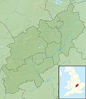
 Location of the river mouth in Northamptonshire | |
| Location | |
| Sovereign State | United Kingdom |
| Country | England |
| County | Northamptonshire |
| Physical characteristics | |
| Source | |
| • location | Desborough |
| • coordinates | 52°27′38″N 0°48′50″W / 52.460459°N 0.814013°W |
| • elevation | 137 m (449 ft) |
| Mouth | River Nene |
• location | Aldwinckle |
• coordinates | 52°25′43″N 0°30′23″W / 52.428576°N 0.506414°W |
• elevation | 28 m (92 ft) |
| Basin size | 73.26 km2 (28.29 sq mi) |
| Basin features | |
| River system | River Nene |
Harper's Brook is a tributary of the River Nene which runs through Northamptonshire.
According to sources (ordnance survey sheet 141) it rises to the North of Desborough and meanders through the north of the county of Northamptonshire, passing through the town of Corby and on until it joins the River Nene at Aldwinckle, just north of Thrapston.
This article is issued from Wikipedia. The text is licensed under Creative Commons - Attribution - Sharealike. Additional terms may apply for the media files.