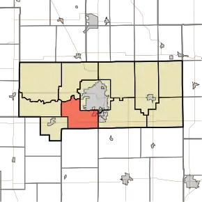
Harrison Township | |
|---|---|
 Intersection of Highway 931 and Highway 26 in Harrison Township | |
 Location in Howard County | |
| Coordinates: 40°26′13″N 86°11′13″W / 40.43694°N 86.18694°W | |
| Country | United States |
| State | Indiana |
| County | Howard |
| Government | |
| • Type | Indiana township |
| Area | |
| • Total | 21.77 sq mi (56.4 km2) |
| • Land | 21.68 sq mi (56.2 km2) |
| • Water | 0.09 sq mi (0.2 km2) 0.41% |
| Elevation | 833 ft (254 m) |
| Population (2020) | |
| • Total | 9,848 |
| • Density | 437.8/sq mi (169.0/km2) |
| GNIS feature ID | 0453389 |
Harrison Township is one of 11 townships in Howard County, Indiana, United States. As of the 2020 census, its population was 9,848, upfrom 9,489 in 2010.[1]
Geography
| Census | Pop. | Note | %± |
|---|---|---|---|
| 2000 | 8,498 | — | |
| 2010 | 9,489 | 11.7% | |
| 2020 | 9,848 | 3.8% | |
| U.S. Census[2] | |||
According to the 2010 census, the township has a total area of 21.77 square miles (56.4 km2), of which 21.68 square miles (56.2 km2) (or 99.59%) is land and 0.09 square miles (0.23 km2) (or 0.41%) is water.[1] Harrison Township was also one of the only townships in Howard County to grow from 2000 to 2010.
Cities and towns
- Kokomo (southwest edge)
Unincorporated towns
Former Settlements
- Alto (annexed into Kokomo in 2012)
- Tarkington
Adjacent townships
- Clay Township (north)
- Center Township (northeast)
- Taylor Township (east)
- Liberty Township, Tipton County (southeast)
- Prairie Township, Tipton County (south)
- Honey Creek Township (west)
- Monroe Township (west)
Cemeteries
The township contains two cemeteries: Sunset Memory Gardens and Twin Spring.
Major highways
Airports and landing strips
- Glenndale Airport
- Ruzicka Airport
Recreation
Golf Courses
- Chipendale Golf Course, located a mile south of SR 26 on Park Road.
- Rice's Golf Center, located on US 31 at Center Road.
- Wildcat Creek Golf Course, located in Timbervalley subdivision, entrances on Center Road and SR 26.
Parks
- Jackson-Morrow Park, entrances located on Park Road between Alto and Center roads as well as on Webster Street.
Schools
Post Offices
- West Middleton Post Office, located at the corner of Alto Road and Rabbit Street.
- Kokomo Main Post Office, located at the corner of Webster Street and Lincoln Road.
Public Safety
- Harrison Township Volunteer Fire Department, 4102 S. Dixon Road
References
- "Harrison Township, Howard County, Indiana". Geographic Names Information System. United States Geological Survey, United States Department of the Interior. Retrieved September 24, 2009.
- United States Census Bureau cartographic boundary files
- 1 2 "Population, Housing Units, Area, and Density: 2010 - County -- County Subdivision and Place -- 2010 Census Summary File 1". United States Census. Archived from the original on February 12, 2020. Retrieved May 10, 2013.
- ↑ "US Census Data". US Government Census Agency. Archived from the original on October 8, 2014. Retrieved February 26, 2014.
External links
This article is issued from Wikipedia. The text is licensed under Creative Commons - Attribution - Sharealike. Additional terms may apply for the media files.