Harry Clever Field | |||||||||||||||
|---|---|---|---|---|---|---|---|---|---|---|---|---|---|---|---|
| Summary | |||||||||||||||
| Airport type | Public | ||||||||||||||
| Owner | City of New Philadelphia | ||||||||||||||
| Serves | New Philadelphia, Ohio | ||||||||||||||
| Elevation AMSL | 894 ft / 272 m | ||||||||||||||
| Coordinates | 40°28′13″N 081°25′12″W / 40.47028°N 81.42000°W | ||||||||||||||
| Map | |||||||||||||||
 PHD  PHD | |||||||||||||||
| Runways | |||||||||||||||
| |||||||||||||||
| Statistics (2023) | |||||||||||||||
| |||||||||||||||
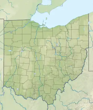
Harry Clever Field (IATA: PHD[2], ICAO: KPHD, FAA LID: PHD) is a public airport three miles southeast of New Philadelphia, in Tuscarawas County, Ohio.[1] The National Plan of Integrated Airport Systems for 2018 categorized it as a general aviation facility.[3]
Lake Central DC-3s stopped at PHD from 1953 to 1961.
Facilities
Harry Clever Field covers 65 acres (26 ha) at an elevation of 894 feet (272 m). It has two runways: 15/33 is 3,951 by 100 feet (1,204 x 30 m) asphalt; 12/30 is 1,907 by 70 feet (581 x 21 m) turf.[1]
In the year ending September 26, 2023, the airport had 21,350 aircraft operations, average 58 per day: 95% general aviation, 4% air taxi, and <1% military. 40 aircraft were then based at the airport: 38 single-engine, and 2 multi-engine.[1]
Accidents and incidents
- On August 9, 2009, a Cessna TR182 impacted a deer during landing at the Harry Clever Field airport. He heard a loud thump and his passenger saw the impact.[4]
See also
References
- 1 2 3 4 FAA Airport Form 5010 for PHD PDF. Federal Aviation Administration. effective November 30, 2023.
- ↑ "IATA Airport Code Search (PHD: New Philadelphia / Harry Clever)". International Air Transport Association. Retrieved December 17, 2012.
- ↑ "National Plan of Integrated Airport Systems (2019-2023)A-1 Appendix A: List of NPIAS Airports with 5-Year Forecast" (PDF, 5.063 MB). National Plan of Integrated Airport Systems (NPIAS) Report Airports. Federal Aviation Administration. 26 September 2018.
- ↑ "Cessna TR182 crash in Ohio (N736UD) | PlaneCrashMap.com". planecrashmap.com. Retrieved 2023-07-29.
External links
- Aerial image as of April 1994 from USGS The National Map
- FAA Terminal Procedures for PHD, effective December 28, 2023
- Resources for this airport:
- FAA airport information for PHD
- AirNav airport information for KPHD
- ASN accident history for PHD
- FlightAware airport information and live flight tracker
- NOAA/NWS weather observations: current, past three days
- SkyVector aeronautical chart, Terminal Procedures