| Hell-to-Finish Formation | |
|---|---|
| Stratigraphic range: | |
| Type | Formation |
| Unit of | Bisbee Group |
| Underlies | U-Bar Formation |
| Overlies | Various Paleozoic units, Broken Jug Formation |
| Thickness | 1,700–3,500 feet (520–1,070 m) |
| Lithology | |
| Primary | Shale, mudstone, siltstone |
| Location | |
| Coordinates | 31°32′36″N 108°20′28″W / 31.5433°N 108.3411°W |
| Region | New Mexico |
| Country | United States |
| Type section | |
| Named for | Hell-to-Finish tank |
| Named by | R.A. Zeller Jr. |
| Year defined | 1965 |
 Hell-to-Finish Formation (the United States)  Hell-to-Finish Formation (New Mexico) | |
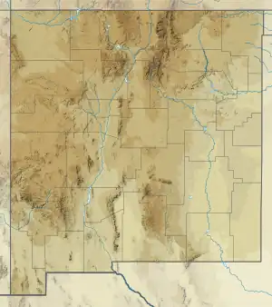
The Hell-to-Finish Formation is a geologic formation in southwestern New Mexico. It preserves fossils dating back to the early Cretaceous period.[1][2][3]
Description
The formation consists mostly of red to red-brown to gray or green shale, mudstone, and arkosic siltstone. The base of the formation is a well indurated conglomerate derived from the underlying Paleozoic beds. Minor arkose and limestone are present in the uppermost beds.[1] The total thickness is up to 1,700–3,500 feet (520–1,070 m) but varies considerably over the region. The formation rests on a profound unconformity with underlying Paleozoic formations in most locations, but overlies the Broken Jug Formation in the Little Hatchet Mountains.[4] The Hell-to-Finish Foramtion is transitional to the overlying U-Bar Formation.[3] The transitional contact with the Aptian U-Bar Formation suggests that the Hell-to-Finish Formation cannot be much older than Aptian.[5]
The formation is interpreted as being deposited in an arid client, based on the nature of paleosols within the formation.[6] Deposition took place in a west-northwest-trending rift basin.[7]
Fossils
The upper beds of the formation contain abundant pelecypods.[1] However, no age-diagnostic fossils have been found in the formation.[5]
History of investigation
The formation was first defined by Zeller in 1965 for exposures near the Hell-to-Finish tank in the southern Big Hatchet Mountains of New Mexico.[1]
See also
Footnotes
- 1 2 3 4 Zeller 1965.
- ↑ Hayes 1970.
- 1 2 Lawton 2004, pp. 159–161.
- ↑ Lucas et al. 2001.
- 1 2 Lucas & Estep 1998.
- ↑ Mack 1992.
- ↑ Mack 1987.
References
- Hayes, P.T. (1970). "Cretaceous paleogeography of southeastern Arizona and adjacent areas". U.S. Geological Survey Professional Paper. 658-B: B1–B42. Retrieved 5 August 2020.
- Lawton, Timothy F. (2004). "Upper Jurassic and lower Cretaceous strata of southwestern New Mexico and northern Chihuahua, Mexico". In Mack, G.H.; Giles, K.A. (eds.). The geology of New Mexico. A geologic history: New Mexico Geological Society Special Volume 11. pp. 153–168. ISBN 9781585460106.
- Lucas, Spencer G.; Estep, John W. (1998). "Lithostratigraphy and biostratigraphy of the lower-middle Cretaceous Bisbee Group, southwestern New Mexico, USA". New Mexico Museum of Natural History and Science Bulletin. 14: 39–55. Retrieved 16 September 2020.
- Lucas, Spencer G.; Zeigler, Kate E.; Lawton, Timothy; Filkorn, Harry (February 2001). "Late Jurassic invertebrate fossils from the Little Hatchet Mountains, southwestern New Mexico". New Mexico Geology. 23: 16–20. doi:10.58799/NMG-v23n1.16. Retrieved 16 September 2020.
- Mack, Greg H. (1 May 1987). "Mid-Cretaceous (late Albian) change from rift to retroarc foreland basin in southwestern New Mexico". GSA Bulletin. 98 (5): 507–514. Bibcode:1987GSAB...98..507M. doi:10.1130/0016-7606(1987)98<507:MLACFR>2.0.CO;2.
- Mack, Greg H. (1992). "Paleosols as an Indicator of Climatic Change at the Early-Late Cretaceous Boundary, Southwestern New Mexico". SEPM Journal of Sedimentary Research. 62. doi:10.1306/D426792E-2B26-11D7-8648000102C1865D.
- Zeller, R.A. Jr. (1965). "Stratigraphy of the Big Hatchet Mountains area, New Mexico" (PDF). New Mexico Bureau of Mines and Mineral Resources Memoir. 16. Retrieved 15 September 2020.