Hengli
横沥镇 | |
|---|---|
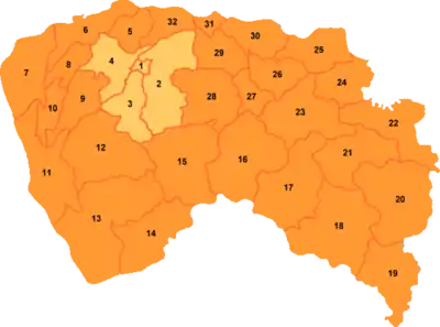 Hengli is labeled '26' on this map of Dongguan | |
 Hengli 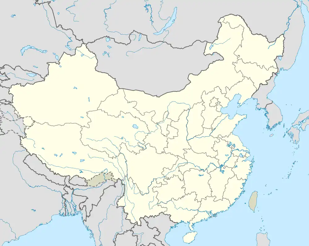 Hengli | |
| Coordinates: 23°01′07″N 113°57′57″E / 23.0185°N 113.9658°E | |
| Country | |
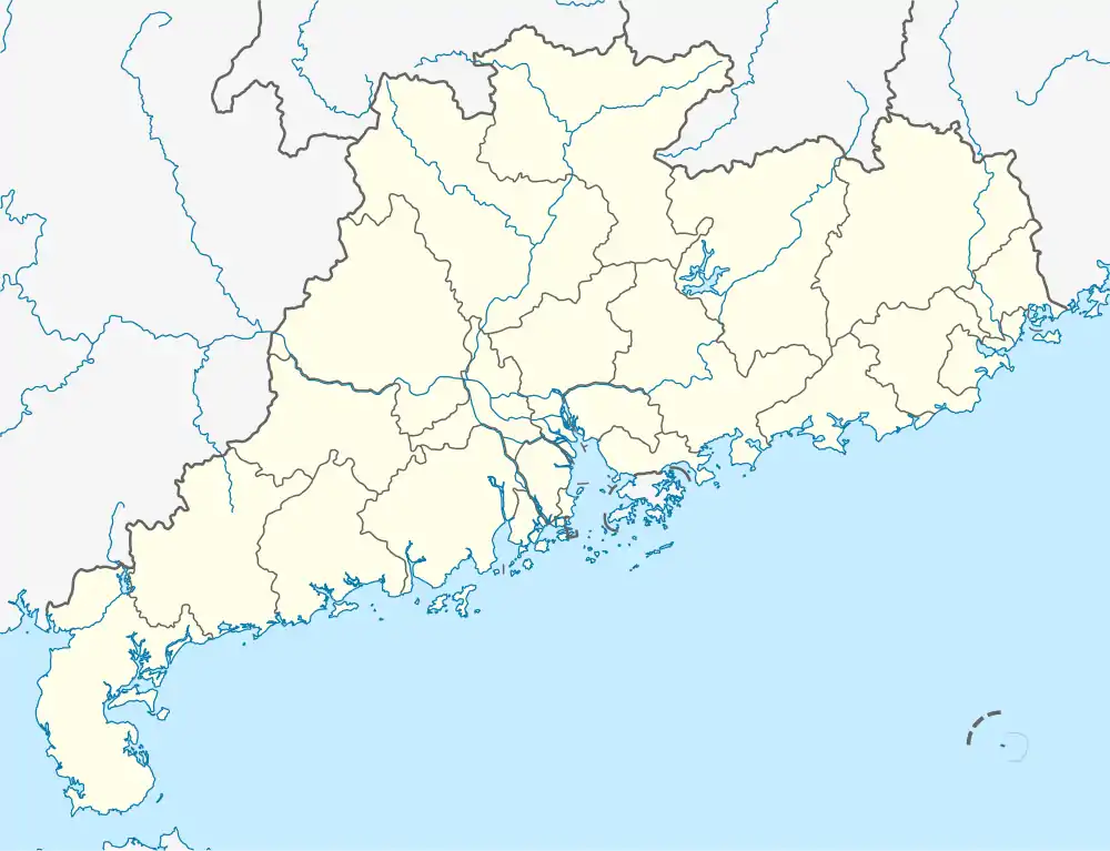
| Province | Guangdong |
| Prefecture-level city | Dongguan |
| Village-level Divisions | 2 communities 16 villages |
| Area | |
| • Total | 47.75 km2 (18.44 sq mi) |
| Elevation | 8 m (26 ft) |
| Population (2020) | |
| • Total | 278,858 |
| • Density | 5,800/km2 (15,000/sq mi) |
| Time zone | UTC+8 (CST) |
| Postal code | 523460 |
Hengli (simplified Chinese: 横沥镇; traditional Chinese: 橫瀝鎮; pinyin: Hénglì zhèn) is a town under the jurisdiction of Dongguan prefecture-level city in the Pearl River Delta region of Guangdong province, China. It is located just north of Changping Town. As of the year 2020, it had a total population of 278,858.[1]
Geography
Hengli Town is located on the banks of Huanbao and Yinhe Rivers. The Congguanshen Expressway crosses the eastern part of the town. It has an average elevation of 8 meters above the sea level.[2]
Climate
Hengli Town has a Humid Subtropical Climate (Cfa). It sees the most rainfall in June, with an average precipitation of 259.8 mm; and the least rainfall in December, with an average precipitation of 25.8 mm.
| Climate data for Hengli | |||||||||||||
|---|---|---|---|---|---|---|---|---|---|---|---|---|---|
| Month | Jan | Feb | Mar | Apr | May | Jun | Jul | Aug | Sep | Oct | Nov | Dec | Year |
| Mean daily maximum °C (°F) | 19 (66) |
20 (68) |
23 (73) |
27 (81) |
30 (86) |
31 (88) |
32 (90) |
32 (90) |
32 (90) |
29 (84) |
26 (79) |
21 (70) |
27 (80) |
| Daily mean °C (°F) | 14 (57) |
16 (61) |
19 (66) |
23 (73) |
26 (79) |
28 (82) |
29 (84) |
29 (84) |
28 (82) |
25 (77) |
21 (70) |
16 (61) |
23 (73) |
| Mean daily minimum °C (°F) | 10 (50) |
12 (54) |
16 (61) |
20 (68) |
24 (75) |
26 (79) |
26 (79) |
26 (79) |
24 (75) |
21 (70) |
16 (61) |
12 (54) |
19 (67) |
| Average rainfall mm (inches) | 31.1 (1.22) |
45.3 (1.78) |
80.8 (3.18) |
156.9 (6.18) |
229.2 (9.02) |
259.8 (10.23) |
212.6 (8.37) |
206.2 (8.12) |
131.0 (5.16) |
49.0 (1.93) |
29.6 (1.17) |
25.8 (1.02) |
1,457.3 (57.38) |
| Average rainy days (≥ 1 mm) | 3.3 | 5.1 | 7.6 | 11.8 | 16.0 | 17.0 | 15.9 | 15.7 | 10.5 | 4.7 | 3.3 | 2.6 | 113.5 |
| Mean daily daylight hours | 10.9 | 11.4 | 12.0 | 12.7 | 13.3 | 13.5 | 13.4 | 12.9 | 12.3 | 11.6 | 11.0 | 10.7 | 12.1 |
| Source: Weatherspark.com[3] | |||||||||||||
Administrative divisions
In the year 2022, Hengli Town consisted of 18 subdivisions, including the following 2 residential communities and 16 villages:[4]
Residential communities
- Hengquan (恒泉)
- Yuning (裕宁)
Villages
- Shiyong (石涌)
- Gekeng (隔坑)
- Banxianshan (半仙山)
- Hengli (横沥)
- Tiantou (田头)
- Tiankeng (田坑)
- Cuntou (村头)
- Changxiang (长巷)
- Tianraobu (田饶步)
- Liujia (六甲)
- Cunwei (村尾)
- Shuibian (水边)
- Xinsi (新四)
- Shansha (山厦)
- Yuetan (月塘)
- Zhangkeng (张坑)
References
- ↑ "Hénglì Zhèn (Town, China) - Population Statistics, Charts, Map and Location". www.citypopulation.de. Retrieved 29 August 2023.
- ↑ "Hengli topographic map, elevation, terrain". Topographic maps. Retrieved 29 August 2023.
- ↑ "Climate and Average Weather Year Round in Hengli, China". weatherspark.com. Retrieved 29 August 2023.
- ↑ "2022年统计用区划代码和城乡划分代码" [2022 Statistical Division Codes and Urban-rural Differentiation Codes]. www.stats.gov.cn (in Simplified Chinese). Archived from the original on 21 March 2023. Retrieved 29 August 2023.