Herrngiersdorf | |
|---|---|
 Coat of arms | |
Location of Herrngiersdorf within Kelheim district 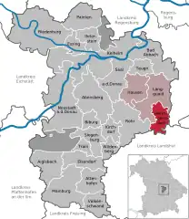 | |
 Herrngiersdorf 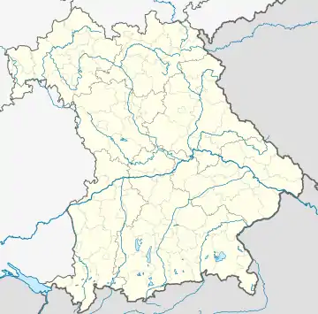 Herrngiersdorf | |
| Coordinates: 48°48′N 12°4′E / 48.800°N 12.067°E | |
| Country | Germany |
| State | Bavaria |
| Admin. region | Niederbayern |
| District | Kelheim |
| Municipal assoc. | Langquaid |
| Area | |
| • Total | 25.09 km2 (9.69 sq mi) |
| Elevation | 405 m (1,329 ft) |
| Population (2022-12-31)[1] | |
| • Total | 1,389 |
| • Density | 55/km2 (140/sq mi) |
| Time zone | UTC+01:00 (CET) |
| • Summer (DST) | UTC+02:00 (CEST) |
| Postal codes | 84097 |
| Dialling codes | 09452 |
| Vehicle registration | KEH |
| Website | www |
Herrngiersdorf is a municipality in the district of Kelheim in Bavaria in Germany. The village is dominated by the large, square Schloss Herrngiersdorf, a brewery.
Geography
Herrngiersdorf is located south of Langquaid and consists of Herrngiersdorf, Sandsbach, Semerskirchen, and Sittelsdorf.
Gallery
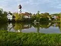 Lake at Semerskirchen
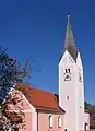 St. Martin's church
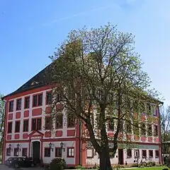
References
- ↑ Genesis Online-Datenbank des Bayerischen Landesamtes für Statistik Tabelle 12411-003r Fortschreibung des Bevölkerungsstandes: Gemeinden, Stichtag (Einwohnerzahlen auf Grundlage des Zensus 2011)
Wikimedia Commons has media related to Herrngiersdorf.
Wikivoyage has a travel guide for Herrngiersdorf.
Towns and municipalities in Kelheim (district) | ||
|---|---|---|
Coat of Arms of Kelheim district | ||
This article is issued from Wikipedia. The text is licensed under Creative Commons - Attribution - Sharealike. Additional terms may apply for the media files.