| Hillsdale Lake | |
|---|---|
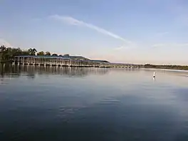 Hillsdale Lake Marina | |
 Hillsdale Lake  Hillsdale Lake | |
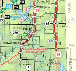 KDOT map of Miami County (legend) | |
| Location | Miami County, Kansas |
| Coordinates | 38°39′24″N 94°54′34″W / 38.65667°N 94.90944°W |
| Type | Reservoir |
| Primary inflows | Big Bull Creek |
| Primary outflows | Big Bull Creek → Marais des Cygnes River → Osage River |
| Basin countries | United States |
| Managing agency | U.S. Army Corps of Engineers |
| Surface area | 4,580 acres (1,850 ha) |
| Max. depth | 57 ft (17 m) |
| Surface elevation | 917 ft (280 m) |
| Settlements | Hillsdale, Paola, Spring Hill, Edgerton |
| References | [1] |
Hillsdale Lake is a reservoir located in the northwestern part of Miami County, in northeast Kansas and the central United States; it is approximately 30 mi (48 km) from Kansas City. The surface area of the lake is approximately 4,580 acres (18.5 km2), and the lake has a maximum depth of approximately 57 ft (17 m).
Hillsdale Dam, impounding the Big Bull Creek to create the V-shaped reservoir, was completed in 1982 as a flood control project of the United States Army Corps of Engineers.[2] Fix link* The reservoir has a normal storage capacity of 76,000 acre-feet.[3] No hydroelectric power is generated by the earthen dam. Recreational facilities include Hillsdale State Park, opened in 1994.[4]
See also
References
- ↑ "Hillsdale Lake". Geographic Names Information System. United States Geological Survey, United States Department of the Interior. October 13, 1978. Retrieved January 15, 2021.
- ↑ "Project Goals". Archived from the original on 2010-02-21. Retrieved 2012-07-21.
- ↑ "Hillsdale Lake". Archived from the original on 2012-11-02. Retrieved 2012-07-21.
- ↑ "Hillsdale".
External links
- Hillsdale Lake, official website
This article is issued from Wikipedia. The text is licensed under Creative Commons - Attribution - Sharealike. Additional terms may apply for the media files.