Himmafushi | |
|---|---|
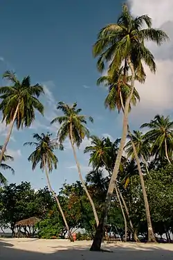
 View of Jafana Park, A famous beach area in Himmafushi. | |
 Himmafushi Location in Maldives | |
| Coordinates: 04°18′33″N 73°34′15″E / 4.30917°N 73.57083°E | |
| Country | Maldives |
| Administrative atoll | Kaafu Atoll |
| Distance to Malé | 16.32 km (10.14 mi) |
| Government | |
| • Council | Himmafushi Council |
| Dimensions | |
| • Length | 0.900 km (0.559 mi) |
| • Width | 0.750 km (0.466 mi) |
| Population (2014)[1] | |
| • Total | 1,725 (including foreigners) |
| Time zone | UTC+05:00 (MST) |
| Website | visithimmafushi himmafushi |
Himmafushi (Dhivehi: ހިއްމަފުށި) is one of the inhabited islands of Kaafu Atoll in the Maldives.
Geography
The island is 16.32 km (10 mi; 9 nmi) northeast of the country's capital, Malé.[2] It is located in North Malé Atoll. Himmafushi is about 18 km (11 mi) from Male Airport. The only way to reach it is by boat.
Demography
| Year | Pop. | ±% |
|---|---|---|
| 2006 | 1,007 | — |
| 2014 | 1,334 | +32.5% |
| 2006-2014: Census populations Source: [3] | ||
Economy
The island has its own fish processing company and a boat building facility to ease the demands of its own people.
Infrastructure
Himmafushi has about 850 locals but the population can rise to over 2000 as Himmafushi also houses the minor delinquent prison and a drug rehabilitation centre. Industry in Himmafushi consists of a water bottling facility and a tuna factory.
Tourism
Himmafushi is less than a km long and wide. There is no alcohol obtainable on the island.
Sport
Himmafushi, a local island, is geographically recognized for its surfing and diving spots.
Transport
To reach the hotels on Himmafushi Island, a public ferryboat or chartered speedboat can be arranged.
Ferry
The ferry takes 50 minutes to reach Himmafushi Island. The ferry departs from Male’ at 14:30 hrs, and the return journey departs from Himmafushi Island at 08:00 hrs. For flights landing after 13:00 hrs, passengers need to take the speedboat transfer or make arrangements to stay in Male’.
References
- ↑ "Table PP5: Resident Population by sex, nationality and locality (administrative islands), 2014" (PDF). Population and Households Census 2014. National Bureau of Statistics. p. 34. Retrieved 12 August 2018.
- ↑ "Coordinate Distance Calculator". Boulter.com. Retrieved 12 August 2018.
- ↑ "Table 3.3: Total Maldivian Population by Islands" (PDF). National Bureau of Statistics. Retrieved 12 August 2018.