| Hinton New South Wales | |||||||||||||||
|---|---|---|---|---|---|---|---|---|---|---|---|---|---|---|---|
 Historic Hinton bridge, built in 1901 | |||||||||||||||
 Hinton | |||||||||||||||
| Coordinates | 32°43′S 151°39′E / 32.717°S 151.650°E | ||||||||||||||
| Population | 448 (2016 census)[1] | ||||||||||||||
| • Density | 45.71/km2 (118.4/sq mi) | ||||||||||||||
| Postcode(s) | 2321 | ||||||||||||||
| Elevation | 6 m (20 ft)[Note 1] | ||||||||||||||
| Area | 9.8 km2 (3.8 sq mi)[Note 2] | ||||||||||||||
| Time zone | AEST (UTC+10) | ||||||||||||||
| • Summer (DST) | AEDT (UTC+11) | ||||||||||||||
| Location |
| ||||||||||||||
| LGA(s) | Port Stephens Council | ||||||||||||||
| Region | Hunter | ||||||||||||||
| County | Durham[2] | ||||||||||||||
| Parish | Seaham[2] | ||||||||||||||
| State electorate(s) | Port Stephens | ||||||||||||||
| Federal division(s) | Paterson | ||||||||||||||
| |||||||||||||||
Hinton is a suburb of the Port Stephens local government area in the Hunter Region of New South Wales, Australia.[3] Primarily rural, the largest population centre is the township of Hinton, which is situated on the Paterson River, near to the confluence of the Hunter and Paterson rivers.[4] In 1835 the post office requested a name for the town and the surveyor general suggested Hinton prior to this it was known as the second arm of the hunter river.[5] The first European settlers were 12 ex convicts in 1818.[6]
Floods
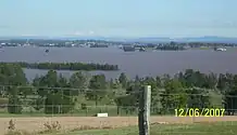
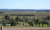
Due to the close proximity of the Hunter and Paterson rivers and the low elevation of surrounding ground the town is often isolated for a number of days during periods of exceptionally high rainfall. Most recently this happened in March 2000 and June 2007.
Hinton School of Arts
Located on 279 Hinton is large sandstone building a brick structure.[7] On 12 December 1868 tenders were released for the creation of the building.[8] The builder was J Coulton and architects were Bell and Franklin.[8] The Foundation Stone was laid in February 1869.[8] It was finished and opened on 25 September 1869.[8]
Hinton Baptist Church
In 1848 it started as a Sunday School in a home then a hall.[9] Rev Phillip Lane joined the fellowship and began the first pastor in August 1856.[9] He had a many skills as oversaw the construction of the church from the existing building.[9] The church formally opened on 16 July 1857 as the third Baptist church building in Australia.[9]


Heritage listings
Hinton has a number of heritage-listed sites, including:
- Hinton-Morpeth Road: Paterson River bridge[10]
Population
In the 2016 Census, there were 448 people in Hinton. 89.9% of people were born in Australia and 95.7% of people spoke only English at home. The most common responses for religion were Catholic 33.5% and Anglican 28.8%.[1]
Notes
References
- 1 2 Australian Bureau of Statistics (27 June 2017). "Hinton (State Suburb)". 2016 Census QuickStats. Retrieved 16 June 2019.
 Material was copied from this source, which is available under a Creative Commons Attribution 4.0 International License.
 - 1 2 "Hinton". Geographical Names Register (GNR) of NSW. Geographical Names Board of New South Wales. Retrieved 27 May 2008.
- ↑ "Suburb Search - Local Council Boundaries - Hunter (HT)". New South Wales Division of Local Government. Archived from the original on 7 June 2008. Retrieved 27 May 2008.
- ↑ "Hinton". Land and Property Management Authority - Spatial Information eXchange. New South Wales Land and Property Information. Retrieved 27 May 2008.
- ↑ "How Hinton got its name". Victoria Hotel. Retrieved 9 September 2020.
- ↑ "Hinton, NSW". Aussie Towns. Retrieved 16 October 2020.
- ↑ "Hinton School of Arts". portstephens.nsw.gov.au. Retrieved 4 November 2020.
- 1 2 3 4 admin. "School of Arts". Victoria Hotel Hinton. Retrieved 4 November 2020.
- 1 2 3 4 "Our Church | Historic Hinton Baptist Church". Retrieved 4 November 2020.
- ↑ "Hinton Bridge over Paterson River". New South Wales State Heritage Register. Department of Planning & Environment. H01470. Retrieved 18 May 2018.
 Text is licensed by State of New South Wales (Department of Planning and Environment) under CC-BY 4.0 licence.
External links
![]() Media related to Hinton, New South Wales at Wikimedia Commons
Media related to Hinton, New South Wales at Wikimedia Commons