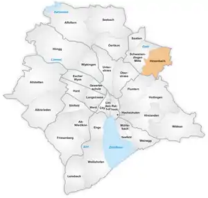
The quarter of Hirzenbach in Zürich
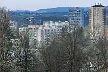
Apartment buildings in Hirzenbach as seen from Sagentobel valley on Adlisberg (April 2010)
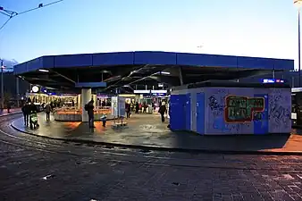
Stettbach S-Bahn Zürich train station (December 2009)

Winterthurerstrasse towards Stettbach respectively Dübendorf as seen from Schwamendingen Mitte (December 2009)
Hirzenbach is a quarter in the district 12 of Zürich, located in the Glatt Valley (German: Glattal).
It was part of Schwamendingen municipality that was amalgamated into Zürich in 1934.
The quarter has a population of 11,265 distributed on an area of 2.62 km2 (1.01 sq mi).
References
![]() Media related to Hirzenbach at Wikimedia Commons
Media related to Hirzenbach at Wikimedia Commons
47°24′16.66″N 8°35′14.31″E / 47.4046278°N 8.5873083°E
This article is issued from Wikipedia. The text is licensed under Creative Commons - Attribution - Sharealike. Additional terms may apply for the media files.