 | |
|---|---|
| Đường cao tốc %paddedRoute% | |
| Ho Chi Minh City–Long Thanh–Dau Giay Expressway | |
 | |
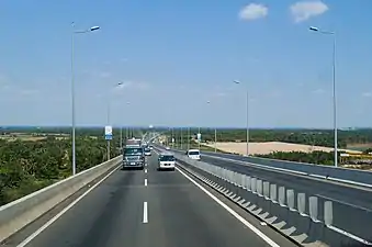
 Long Thanh bridge on the route pass Dong Nai river | |
| Route information | |
| Length | 34 mi (55 km) |
| Existed | February 2015–present |
| Major junctions | |
| West end | Mai Chi Tho, Luong Dinh Cua, and Nguyen Thi Dinh street at An Phú Intersection, District 2, Ho Chi Minh City |
| |
| East end | |
| Location | |
| Country | Vietnam |
| Highway system | |
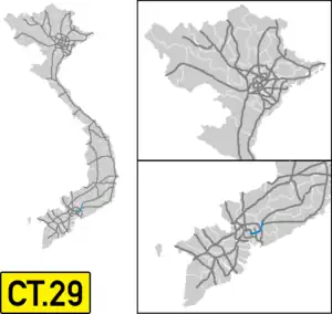
The Ho Chi Minh City–Long Thanh–Dau Giay Expressway (![]() ) is a 55-kilometre-long (34 mi) highway in Vietnam. This expressway opened in February 2015, connects Ho Chi Minh City with Thong Nhat, Dong Nai. The estimated investment capital is around 18,000 billion VND (equivalent to US$1.2 billion). The expressway starts at An Phu Intersection, District 2, Ho Chi Minh City and ends at Dau Giay Interchange, Thong Nhat, Dong Nai. At Dau Giay, it ends at a partially completed cloverleaf interchange with the north–south highway. From here, the planned Dau Giay-Dalat Expressway will start. The North-South Expressway will branch of eastbound in the direction of Phan Thiet.[1]
) is a 55-kilometre-long (34 mi) highway in Vietnam. This expressway opened in February 2015, connects Ho Chi Minh City with Thong Nhat, Dong Nai. The estimated investment capital is around 18,000 billion VND (equivalent to US$1.2 billion). The expressway starts at An Phu Intersection, District 2, Ho Chi Minh City and ends at Dau Giay Interchange, Thong Nhat, Dong Nai. At Dau Giay, it ends at a partially completed cloverleaf interchange with the north–south highway. From here, the planned Dau Giay-Dalat Expressway will start. The North-South Expressway will branch of eastbound in the direction of Phan Thiet.[1]
The expressway has five junctions. The fastest allowed speed is 120 kilometres per hour (75 mph) and the slowest is 60 kilometres per hour (37 mph).


References
- ↑ "Cao tốc Dầu Giây - Liên Khương khởi công năm 2019 với nguồn vốn 65.000 tỉ đồng". Báo Thanh Niên (in Vietnamese). 2019-05-06. Retrieved 2020-01-31.
