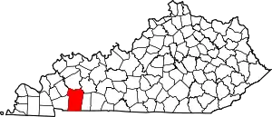
Honey Grove, Kentucky | |
|---|---|
 Honey Grove Location within the state of Kentucky  Honey Grove Honey Grove (the United States) | |
| Coordinates: 36°53′23″N 87°18′35″W / 36.88972°N 87.30972°W | |
| Country | United States |
| State | Kentucky |
| County | Christian |
| Elevation | 715 ft (218 m) |
| Time zone | UTC-6 (Central (CST)) |
| • Summer (DST) | UTC-5 (CDT) |
| GNIS feature ID | 494479[1] |
Honey Grove, sometimes spelled as Honeygrove,[2] is an unincorporated community in Christian County, Kentucky, United States. Kentucky Route 508 runs through the community.[3] Honey Grove has a single firehouse that is staffed by volunteer personnel.[4]
The McClellen House is located in Honey Grove, and was listed on the U.S. National Register of Historic Places in 1979.[3]
References
- ↑ U.S. Geological Survey Geographic Names Information System: Honey Grove, Kentucky
- ↑ Field operations of the Bureau of Soils, 1912 - General review of the work: 1912. USDA. 1915. p. 1149. Retrieved September 23, 2018.
- 1 2 "NPGallery Asset Detail". NPGallery Search. Retrieved September 23, 2018.
- ↑ "Honey Grove". KentuckyFireTrucks. November 6, 2008. Retrieved September 23, 2018.
Further reading
- Butts, C. (1917). Mississippian Formations of Western Kentucky. State journal Company, printer to the commonwealth. p. 69. Retrieved September 23, 2018.
This article is issued from Wikipedia. The text is licensed under Creative Commons - Attribution - Sharealike. Additional terms may apply for the media files.
