51°52′N 4°59′E / 51.867°N 4.983°E
Hoogblokland | |
|---|---|
 Coat of arms | |
 | |
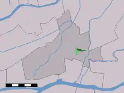 The village centre (dark green) and the statistical district (light green) of Hoogblokland in the municipality of Giessenlanden. | |
| Country | Netherlands |
| Province | South Holland |
| Municipality | Molenlanden |
| Population | 1,440 |

Church: de Dorpskerk
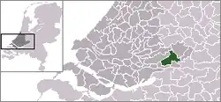
Hoogblokland is a village in the Dutch province of South Holland. It is a part of the municipality of Molenlanden, and lies about 4 km north of Gorinchem.
In 2001, the village of Hoogblokland had 935 inhabitants. The built-up area of the village was 0.25 km², and contained 372 residences.[1] The statistical area "Hoogblokland", which also can include the peripheral parts of the village, as well as the surrounding countryside, has a population of around 1100.[2]
Hoogblokland was a separate municipality until 1986, when it became a part of Giessenlanden.[3]
References
- ↑ Statistics Netherlands (CBS), Bevolkingskernen in Nederland 2001 Archived 2006-03-19 at the Wayback Machine. (Statistics are for the continuous built-up area).
- ↑ Statistics Netherlands (CBS), Statline: Kerncijfers wijken en buurten 2003-2005. As of 1 January 2005.
- ↑ Ad van der Meer and Onno Boonstra, Repertorium van Nederlandse gemeenten, KNAW, 2011.
This article is issued from Wikipedia. The text is licensed under Creative Commons - Attribution - Sharealike. Additional terms may apply for the media files.