Hopang | |
|---|---|
Town | |
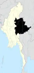
 Hopang Location in Myanmar (Burma) | |
| Coordinates: 23°25′29″N 98°45′08″E / 23.4248°N 98.7523°E | |
| Country | |
| State | |
| Self-Administered Division | Wa Self-Administered Division |
| District | Hopang District |
| Township | Hopang Township |
| Population | |
| • Ethnicities | Wa |
| Time zone | UTC+6.30 (MMT) |
Hopang is the capital of Hopang Township, Shan State, Myanmar (Burma). It is also the government designated capital of the Wa Self-Administered Division.[1][2]
Geography
Hopang is located in the valley of the Nam Ting River, a tributary of the Salween.[3][4]
Further reading
- Harold Mason Young, Burma Headhunters, Xlibris, 2014, ISBN 978-1503514195
References
- ↑ Geographic.org.
- ↑ Shanland Archived 2010-08-09 at the Wayback Machine
- ↑ Kunmin, Myanmar
- ↑ GoogleEarth

This article is issued from Wikipedia. The text is licensed under Creative Commons - Attribution - Sharealike. Additional terms may apply for the media files.