| Howdendyke | |
|---|---|
 Howdendyke Main street | |
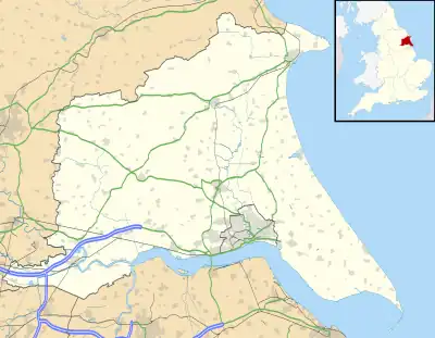
 Howdendyke Location within the East Riding of Yorkshire | |
| OS grid reference | SE754269 |
| • London | 155 mi (249 km) S |
| Civil parish | |
| Unitary authority | |
| Ceremonial county | |
| Region | |
| Country | England |
| Sovereign state | United Kingdom |
| Post town | GOOLE |
| Postcode district | DN14 |
| Dialling code | 01430 |
| Police | Humberside |
| Fire | Humberside |
| Ambulance | Yorkshire |
| UK Parliament | |
Howdendyke is a hamlet in the East Riding of Yorkshire, England. It is situated approximately 2 miles (3.2 km) north of Goole town centre and about 1 mile (1.6 km) south of Howden.
.jpg.webp)
MV Cedar alongside the jetties at Howdendyke
Howdendyke forms part of the civil parish of Kilpin.
It lies on the north bank of the River Ouse and has port facilities run by PD Ports.[1]
References
- Gazetteer — A–Z of Towns Villages and Hamlets. East Riding of Yorkshire Council. 2006. p. 7.
- Porteous, John Douglas (1989). Planned to death: the annihilation of a place called Howdendyke. Manchester University Press ND. ISBN 0-7190-2831-0.
Wikimedia Commons has media related to Howdendyke.
This article is issued from Wikipedia. The text is licensed under Creative Commons - Attribution - Sharealike. Additional terms may apply for the media files.