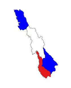
Hpa-an Township
ဘားအံမြို့နယ် ဖၣ်အၣ်ကီၢ်ဆၣ် | |
|---|---|
 Location in Hpa-an district | |
| Country | |
| Division | Kayin State |
| District | Hpa-an District |
| Area | |
| • Total | 1,119 sq mi (2,899 km2) |
| Population (2014) | 422,367 |
| Time zone | UTC+6:30 (MMT) |
Hpa-an Township (Phlone ထ်ုအင်ကၞင့်; Burmese: ဘားအံမြို့နယ်, S'gaw Karen: ဖၣ်အၣ်ကီၢ်ဆၣ်) is a township of Hpa-an District in the Kayin State of Myanmar.[1] The principal town is Hpa-An.
References
- ↑ "Myanmar States/Divisions & Townships Overview Map" (PDF). www.burmalibrary.org. Archived from the original (PDF) on 2010-12-03.
16°53′00″N 97°38′00″E / 16.8833°N 97.6333°E
This article is issued from Wikipedia. The text is licensed under Creative Commons - Attribution - Sharealike. Additional terms may apply for the media files.
