| Hualapai Peak | |
|---|---|
 | |
| Highest point | |
| Elevation | 8,417 ft (2,566 m)[1] |
| Prominence | 4,439 ft (1,353 m)[1] |
| Isolation | 95.22 mi (153.24 km)[1] |
| Coordinates | 35°04′30″N 113°54′03″W / 35.07500°N 113.90083°W[2] |
| Geography | |
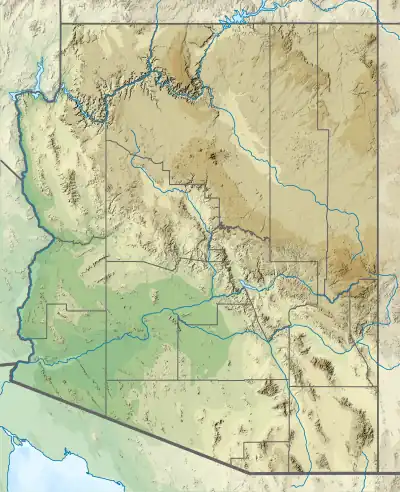 Hualapai Peak Location in the state of Arizona | |
| Location | Mohave County, Arizona, US |
| Parent range | Hualapai Mountains |
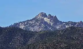
Hualapai Peak is a 8,417-foot (2,566 m) mountain summit in Mohave County, Arizona and is the highest point of the Hualapai Mountains.[1] It is located about 15 miles (24 km) southeast of Kingman in Hualapai Mountain County Park.

Picture taken of the surrounding landscape from near the summit of Hualapai Peak in Arizona.
The mountain is characterized by huge granite outcroppings and pillars, a result of its volcanic origin. Although trails lead to its base, a moderate scramble and climb is required to reach the summit.[3]
There are also climbing routes along the trail to the peak.
It is named after the Hualapai Native American tribe. Hualapai means "people of the tall pines".[4]
See also
Wikimedia Commons has media related to Hualapai Peak.
References
- 1 2 3 4 "Hualapai Peak, Arizona". Peakbagger. Retrieved 12 July 2017.
- ↑ U.S. Geological Survey Geographic Names Information System: Hualapai Peak
- ↑ "Hualapai Peak". SummitPost. 3 Sep 2014. Retrieved 12 July 2017.
- ↑ "About Hualapai « The Hualapai Tribe Website". hualapai-nsn.gov.
This article is issued from Wikipedia. The text is licensed under Creative Commons - Attribution - Sharealike. Additional terms may apply for the media files.