Hulcote and Salford | |
|---|---|
Civil parish | |
| Coordinates: 52°02′35″N 0°37′52″W / 52.043°N 0.631°W | |
| Country | England |
| Primary council | Central Bedfordshire |
| County | Bedfordshire |
| Region | East of England |
| Status | Parish |
| Main settlements | Hulcote Salford |
| Government | |
| • Type | Parish Council |
| • UK Parliament | Mid Bedfordshire |
| Population (2011) | |
| • Total | 209 |
| [1] | |
| Area code | MK |
Hulcote and Salford is a civil parish in the district of Central Bedfordshire in the county of Bedfordshire.[2] The parish was formed in 1933 by the union of the civil parishes of Hulcote and Salford. Until 1974 the parish was part of the Ampthill rural district.
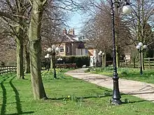
Hulcote Manor
References
- ↑ "Office for National Statistics 2011". Neighbourhood Staqtistics. Office for National Statistics. Retrieved 9 November 2011.
- ↑ "Ordnance Survey Election Maps". www.ordnancesurvey.co.uk. Ordnance Survey. Retrieved 3 April 2016.
External links
![]() Media related to Hulcote and Salford at Wikimedia Commons
Media related to Hulcote and Salford at Wikimedia Commons
This article is issued from Wikipedia. The text is licensed under Creative Commons - Attribution - Sharealike. Additional terms may apply for the media files.