Central Hulu Sungai Regency
Kabupaten Hulu Sungai Tengah | |
|---|---|
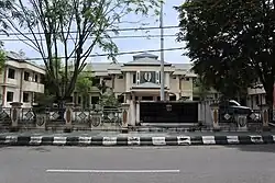 Central Hulu Sungai Regency government office | |
 Coat of arms | |
| Motto: Murakata' | |
 Location within South Kalimantan | |
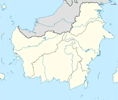 Central Hulu Sungai Regency Location in Kalimantan and Indonesia  Central Hulu Sungai Regency Central Hulu Sungai Regency (Indonesia) | |
| Coordinates: 2°35′S 115°23′E / 2.583°S 115.383°E | |
| Country | Indonesia |
| Province | South Kalimantan |
| Capital | Barabai |
| Established | 24 December 1959 |
| Government | |
| • Regent | H.A. Chairansyah |
| • Vice Regent | vacant |
| Area | |
| • Total | 1,770.77 km2 (683.70 sq mi) |
| Population (mid 2022 estimate) | |
| • Total | 263,061 |
| • Density | 150/km2 (380/sq mi) |
| [1] | |
| Time zone | UTC+8 (ICST) |
| Area code | (+62) 517 |
| Website | hulusungaitengahkab.go.id |
Central Hulu Sungai Regency is one of the regencies in the Indonesian province of South Kalimantan. The area is 1,770.77 km2 and the population was 243,460 at the 2010 Census[2] and 258,721 at the 2020 Census;[3] the official estimate as at mid 2022 was 263,061 (comprising 132,155 males and 130,906 females).[1] The administrative centre is the town of Barabai.
Administrative districts
Central Hulu Sungai Regency is divided into eleven districts (kecamatan), listed below with their areas and their populations at the 2010 Census[2] and 2020 Census,[3] together with the official estimates as at mid 2022.[1] The table includes the locations of the district administrative centres, the number of administrative villages in each district (a total of 161 rural desa and 8 urban kelurahan), and its post code.
| Kode Wilayah | Name of District (kecamatan) | Area in km2 | Pop'n Census 2010 | Pop'n Census 2020 | Pop'n Estimate mid 2022 | Admin centre | No. of villages | Post code |
|---|---|---|---|---|---|---|---|---|
| 63.07.01 | Haruyan | 101.35 | 20,468 | 21,635 | 21,968 | Haruyan | 17 | 71363 |
| 63.07.02 | Batu Benawa | 55.44 | 18,360 | 19,699 | 20,060 | Pagat | 14 | 71371 |
| 63.07.09 | Hantakan | 208.55 | 11,648 | 12,393 | 12,600 | Hantakan | 12 | 71372 |
| 63.07.07 | Batang Alai Selatan (South Batang Alai) | 76.06 | 21,879 | 23,560 | 24,008 | Birayang | 19 (a) | 71381 |
| 63.07.10 | Batang Alai Timur (East Batang Alai) | 778.71 | 6,989 | 7,099 | 7,153 | Tandilang | 11 | 71382 |
| 63.07.06 | Barabai | 40.71 | 52,662 | 55,754 | 56,628 | Barabai Utara | 18 (b) | 71311 -71315 |
| 63.07.03 | Labuan Amas Selatan (South Labuan Amas) | 97.82 | 26,256 | 28,436 | 29,010 | Pantai Hambawang Timur | 18 (c) | 71361 |
| 63.07.04 | Labuan Amas Utara (North Labuan Amas) | 170.32 | 27,321 | 27,023 | 27,146 | Kasarangan | 16 | 71362 |
| 63.07.05 | Pandawan | 116.41 | 30,768 | 34,103 | 34,947 | Pandawan | 21 | 71352 |
| 63.07.08 | Batang Alai Utara (North Batang Alai) | 65.36 | 17,288 | 18,040 | 18,272 | Ilung | 14 | 71391 |
| 63.07.11 | Limpasu | 61.04 | 9,821 | 10,979 | 11,269 | Limpasu | 9 | 71392 |
| Totals | 1,770.77 | 243,460 | 258,721 | 263,061 | Barabai | 169 |
Notes: (a) includes one kelurahan - Birayang. (b) includes 6 kelurahan - Barabai Barat, Barabai Darat, Barabai Selatan, Barabai Timur, Barabai Utara and Bukat. (c) includes one kelurahan - Pantai Hambawang Barat.
References
External links
Regencies and cities of South Kalimantan | ||
|---|---|---|
Capital: Banjarbaru | ||
| Regencies | ||
| Cities | ||