| Hundred of Evan New South Wales | |||||||||||||||
|---|---|---|---|---|---|---|---|---|---|---|---|---|---|---|---|
 The parishes which were part of the Hundred of Evan | |||||||||||||||
| Established | 1835 | ||||||||||||||
| Abolished | 1888 | ||||||||||||||
| LGA(s) | City of Penrith | ||||||||||||||
| County | Cumberland | ||||||||||||||
| |||||||||||||||
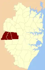
The Hundred of Evan was a former lands administrative division located on the western edge of Greater Sydney, corresponding approximately to the modern City of Penrith. It was one of the thirteen hundreds in the County of Cumberland, which were published in the government gazette of May 27, 1835,[1] and repealed on January 21, 1888.[2]
Upon its creation as a Hundred in 1835, Evan was divided into three parishes, being (from east to west) Melville, Claremont, and Mulgoa.[3]
Evan District
The area had been settled for several decades, and was originally known as the District of Evan, and was founded on the eastern side of the Nepean River. It was named in honour of Sir Evan Nepean. The earliest known newspaper reference to the Evan District dates to 1803,[4] when the first grants of land were issued there.
Evan District's first town, Castlereagh, was one of the five Macquarie Towns, planned by Governor Macquarie in 1810.

However, over time, Castlereagh became overshadowed by the area's other significant town, Penrith, which grew up at the crossing-point of the road over the Nepean River, leading to the way over the Blue Mountains. The gradual disappearance of the district's name, Evan, was helped by its often being displaced by the more popularly used name of the nearby river, the Nepean.
References
- ↑ "Letters Patent for Erecting the County of Cumberland, and Dividing the same into Hundreds and Parishes", New South Wales Government Gazette (Sydney, NSW), Wed 27 May 1835 (Issue No.168 (SUPPLEMENT)), Page 331.
- ↑ "Proclamation by His Excellency The Right Honourable Charles Robert .. Governor and Commander-in-Chief of the Colony of New South Wales and its Dependencies", New South Wales Government Gazette (Sydney, NSW), Sat 21 Jan 1888 (Issue No.63 (SUPPLEMENT)), Page 594.
- ↑ "Letters Patent for Erecting the County of Cumberland, and Dividing the same into Hundreds and Parishes", New South Wales Government Gazette (Sydney, NSW), Wed 27 May 1835 (Issue No.168 (SUPPLEMENT)), Page 340.
- ↑ "General Orders", in The Sydney Gazette and New South Wales Advertiser, Sun 24 Jul 1803, Page 1.
External links
- The Parish Map, Board of Surveying and Spatial Information of New South Wales
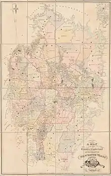
- A map of the County of Cumberland in the Colony of New South Wales, 1840. National Library of Australia MAP F 263.
- A map of the County of Cumberland in the colony of New South Wales 1848. National Library of Australia MAP F 104