State Highway 34 | ||||
|---|---|---|---|---|
| Pioneer Historic Byway | ||||
SH-34 highlighted in red | ||||
| Route information | ||||
| Maintained by ITD | ||||
| Length | 105.980 mi[1] (170.558 km) | |||
| Major junctions | ||||
| South end | ||||
| North end | ||||
| Location | ||||
| Country | United States | |||
| State | Idaho | |||
| Counties | Franklin, Caribou | |||
| Highway system | ||||
| ||||
| ||||
State Highway 34 (SH-34) is a state highway serving Franklin and Caribou counties in southeastern Idaho. The highway runs northeasterly along the Bear River from Preston towards Soda Springs and the Wyoming state line, where it terminates and becomes Wyoming Highway 239.
The entire highway is designated as the Pioneer Historic Byway, a National Scenic Byway following a historic pioneer route. The designation continues south on U.S. Route 91 through Preston and Franklin towards the Utah state line.[2][3]
Route description

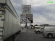
State Highway 34 begins north of downtown Preston at an intersection with U.S. Route 91. The highway, temporarily concurrent with State Highway 36, travels north from Preston through the communities of Thatcher and Grace, following the course of the Bear River. North of Grace, State Highway 34 intersects U.S. Route 30 and becomes concurrent with the highway while continuing east into Soda Springs. From Soda Spring, the highway continues north towards the Blackfoot Reservoir and Grays Lake National Wildlife Refuge, turning east to cross the Caribou Mountains. State Highway 34 ends at the Wyoming state line north of Freedom, where Wyoming Highway 239 begins its short route to U.S. Route 89.[4][5]
History
The Bear Lake–Caribou Scenic Route was designated as a state scenic byway in December 1988.[6]
Major intersections
| County | Location | mi[1] | km | Destinations | Notes |
|---|---|---|---|---|---|
| Franklin | Preston | 7.620 | 12.263 | Southern end of SH-36 concurrency | |
| | 13.102 | 21.086 | Northern end of SH-36 concurrency | ||
| Caribou | | 50.476 | 81.233 | Southern end of US 30 concurrency | |
| Soda Springs | 57.757 | 92.951 | Northern end of US 30 concurrency | ||
| | 113.600 | 182.821 | Northern terminus; continues as WY 239 | ||
1.000 mi = 1.609 km; 1.000 km = 0.621 mi
| |||||
See also
References
- 1 2 "Milepoint Log - State Highway 34" (PDF). Idaho Transportation Department. January 26, 2016. Retrieved February 4, 2017.
- ↑ Fanselow, Julie (2017). Idaho Off the Beaten Path: Discover Your Fun. Lanham, Maryland: Rowman & Littlefield. p. 121. OCLC 32272535. Retrieved February 4, 2017 – via Google Books.
- ↑ "Idaho Scenic, Historic and Back Country Byways" (PDF). Idaho Transportation Department. June 2011. p. 32. Retrieved February 4, 2017.
- ↑ Google (February 4, 2017). "State Highway 34" (Map). Google Maps. Google. Retrieved February 4, 2017.
- ↑ Idaho Official State Highway Map (PDF) (Map). Idaho Transportation Department. Retrieved February 4, 2017.
- ↑ "Regular Meeting of the Idaho Transportation Board, December 9, 1988" (PDF). Idaho Transportation Department. December 9, 1988. p. 58. Retrieved February 10, 2023.
External links
![]() Media related to Idaho State Highway 34 at Wikimedia Commons
Media related to Idaho State Highway 34 at Wikimedia Commons

