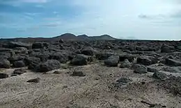
 Raso landscape | |
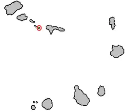 | |
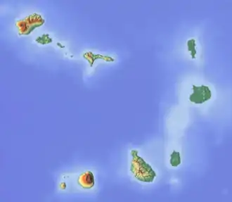 Ilhéu Raso  Ilhéu Raso | |
| Geography | |
|---|---|
| Location | Atlantic Ocean |
| Coordinates | 16°37′0″N 24°35′57″W / 16.61667°N 24.59917°W |
| Archipelago | Cape Verde |
| Area | 5.76 km2 (2.22 sq mi) |
| Length | 3.6 km (2.24 mi) |
| Width | 2.8 km (1.74 mi) |
| Highest elevation | 164 m (538 ft) |
| Administration | |
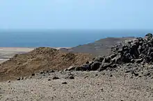
Ilhéu Raso is an uninhabited 5.76 square kilometres (2.22 square miles)[1] volcanic island in the Barlavento archipelago of Cape Verde. It is flanked by the smaller Branco islet to the west and by São Nicolau island on its eastern side. The distance from the island of São Nicolau is 15 kilometres (9.3 miles). Together with Santa Luzia and Ilhéu Branco, Ilhéu Raso is on the tentative list of UNESCO's World Heritage Sites.[2] Since 1990, the islet is part of the protected area Reserva Natural Integral de Santa Luzia.[3]
The island is 3.6 kilometres (2.2 miles) long by 2.8 kilometres (1.7 miles) wide,[4] Its highest point is Monte da Ribeira Ladrão, elevation 164 metres (538 feet) above sea level.[5][6] The south-western part is a dry, boulder-strewn plain. There is little vegetation apart from an area of grassland in the south-west. The entire coastline consists of rocky cliffs.[7]
Fauna
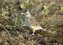
Raso is now the only home of the critically endangered Raso lark (about 45 pairs). The island has been identified as an Important Bird Area (IBA) by BirdLife International because, as well as the larks, it supports populations of Cape Verde shearwaters (with an estimated 2500–3750 breeding pairs), red-billed tropicbirds (25–40 pairs), Cape Verde barn owls and Iago sparrows, others include Oceanodroma castro.[7] It is one of only two islands where the extinct Cape Verde giant skink has been recorded. The giant wall gecko (Tarentola gigas) and a skink (Mabuya stangeri) still occur.[7]
References
- ↑ Resolução nº 36/2016, Estratégia e Plano Nacional de Negócios das Áreas Protegidas
- ↑ Complexe d’aires Protégées de l’île de Santa Luzia et des Ilots Branco et Raso, UNESCO
- ↑ Proposta do Plano de Gestão da Reserva Natural de Santa Luzia, ilhéus Branco e Raso, p. 30
- ↑ Cabo Verde, Statistical Yearbook 2015, Instituto Nacional de Estatística, p. 25
- ↑ Sailing Directions (Enroute), Pub. 143: West Coast of Europe and Northwest Africa (PDF). Sailing Directions. United States National Geospatial-Intelligence Agency. 2017. p. 239.
- ↑ Tactical Pilotage Chart K-0A, Perry–Castañeda Map Collection
- 1 2 3 "Ilhéu Raso". Important Bird Areas factsheet. BirdLife International. 2018. Retrieved 2018-08-17.
External links
- Fauna and flora of Cape Verde
- Ilhéu Raso (BirdLife International)
- « Étude de cas : Ilhéu Raso » (Biosfera I) (in French)