Imèr | |
|---|---|
| Comune di Imer | |
Location of Imèr | |
 Imèr Location of Imèr in Italy 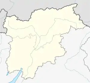 Imèr Imèr (Trentino-Alto Adige/Südtirol) | |
| Coordinates: 46°9′N 11°48′E / 46.150°N 11.800°E | |
| Country | Italy |
| Region | Trentino-Alto Adige/Südtirol |
| Province | Trentino (TN) |
| Frazioni | Masi di Imèr, Pontet |
| Area | |
| • Total | 27.6 km2 (10.7 sq mi) |
| Elevation | 670 m (2,200 ft) |
| Population (Dec. 2004)[2] | |
| • Total | 1,213 |
| • Density | 44/km2 (110/sq mi) |
| Demonym | Almeroi or armeroi |
| Time zone | UTC+1 (CET) |
| • Summer (DST) | UTC+2 (CEST) |
| Postal code | 38050 |
| Dialing code | 0439 |
| Website | Official website |
Imèr is a comune (municipality) in Trentino, located about 50 kilometres (31 mi) east of Trento in northern Italy. As of 31 December 2004, it had a population of 1,213 and an area of 27.6 square kilometres (10.7 sq mi).[3]
Imèr in Autumn

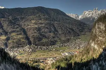
The central part of the village of Imèr
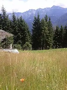
View of the Dolomites from near Imèr
The municipality of Imer contains the frazioni (subdivisions, mainly villages and hamlets) Masi di Imèr, village Sass Maor and Pontet.
Imer borders the following municipalities: Primiero San Martino di Castrozza, Canal San Bovo, Mezzano and Sovramonte.
It includes the Vederne mountain and a part of the Noana valley.
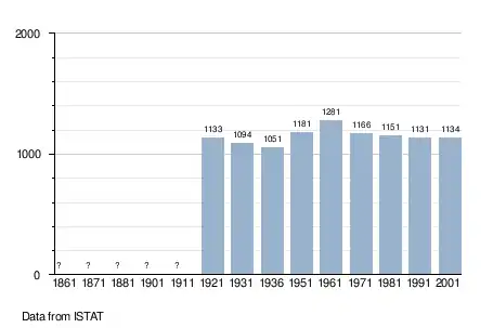
Demographic evolution
References
- ↑ "Superficie di Comuni Province e Regioni italiane al 9 ottobre 2011". Italian National Institute of Statistics. Retrieved 16 March 2019.
- ↑ "Popolazione Residente al 1° Gennaio 2018". Italian National Institute of Statistics. Retrieved 16 March 2019.
- ↑ All demographics and other statistics: Italian statistical institute Istat.
External links
- (in Italian) Homepage of the city

This article is issued from Wikipedia. The text is licensed under Creative Commons - Attribution - Sharealike. Additional terms may apply for the media files.