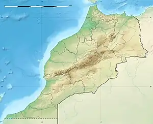
| Imi-n-Ifri Formation | |
|---|---|
| Stratigraphic range: Sinemurian | |
| Type | Geological formation |
| Underlies | Aganane Formation |
| Lithology | |
| Primary | Limestone, dolomite |
| Location | |
| Coordinates | 31°18′N 7°06′W / 31.3°N 7.1°W |
| Approximate paleocoordinates | 24°36′N 6°48′W / 24.6°N 6.8°W |
| Region | Africa |
| Country | |
| Extent | Ouarzazate Province |
 Imi-n-Ifri Formation (Morocco) | |
The Imi-n-Ifri Formation is a Sinemurian geologic formation outcropping about 6 kilometres (3.7 mi) from Demnate, to the east of Marrakech, Morocco. Fossil ornithopod tracks have been reported from the formation.[1]
Description
The formation comprises limestones and dolomites deposited in shallow depth of water, low-energy, marine or lagoonal to supratidal environments. The footprints appear on the surface of a vast limestone on a surface of between 8 and 9,000 square metres (86 and 96,875 sq ft). The top of the carbonate sequence is marked by a bench of yellow 'cargneule' capped by a hardground.[2]
See also
References
- ↑ Weishampel, et al. (2004). "Dinosaur distribution." Pp. 517-607.
- ↑ Adrar-n-Ouglagal tracksite at Fossilworks.org
Bibliography
- Weishampel, David B.; Peter Dodson, and Halszka Osmólska (eds.). 2004. The Dinosauria, 2nd edition, 1–880. Berkeley: University of California Press. Accessed 2019-02-21. ISBN 0-520-24209-2
Further reading
- M. Monbaron, J. Dejax, and G. Demathieu. 1985. Longues pistes de Dinosaures bipèdes à Adrar-n-Ouglagal (Maroc) et répartition des faunes de grands Reptiles dans le domaine atlasique au cours du Mésozoïque. Bulletin du Muséum National D'Histoire Naturelle, 4e série, section A 7(3):229-242
This article is issued from Wikipedia. The text is licensed under Creative Commons - Attribution - Sharealike. Additional terms may apply for the media files.