Ironside, Oregon | |
|---|---|
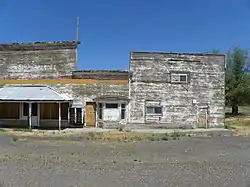 Abandoned building in Ironside | |
 Ironside, Oregon  Ironside, Oregon | |
| Coordinates: 44°19′28″N 117°56′41″W / 44.32444°N 117.94472°W | |
| Country | United States |
| State | Oregon |
| County | Malheur |
| Elevation | 3,783 ft (1,153 m) |
| Time zone | UTC−07:00 (Mountain (MST)) |
| • Summer (DST) | UTC−06:00 (MST) |
| ZIP Code | 97908 |
| Area code | 541 |
| GNIS feature ID | 1136412[1] |
| Coordinates and elevation from Geographic Names Information System[1] | |
Ironside is an unincorporated community in Malheur County, Oregon, United States.[1] The community is 46 miles (74 km) northwest of Vale along U.S. Route 26.[2] Ironside has a post office with ZIP Code 97908.[3]
Climate
According to the Köppen Climate Classification system, Ironside has a semi-arid climate, abbreviated "BSk" on climate maps.[4]
References
- 1 2 3 "Ironside". Geographic Names Information System. United States Geological Survey. November 28, 1980. Retrieved February 1, 2017.
- ↑ Oregon Atlas & Gazetteer (7th ed.). Yarmouth, Maine: DeLorme. 2008. p. 79. ISBN 0-89933-347-8.
- ↑ ZIP Code Lookup
- ↑ "Ironside, Oregon". Weatherbase. CantyMedia. Retrieved February 2, 2017.
External links
- Photos of Ironside from Panoramio
Municipalities and communities of Malheur County, Oregon, United States | ||
|---|---|---|
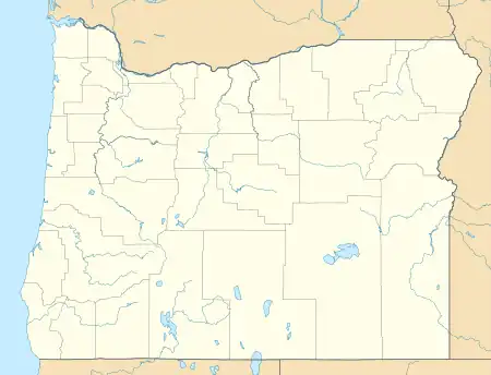
| Cities |  Malheur County map | |
| CDPs | ||
| Other communities | ||
| Ghost town | ||
| Indian reservation | ||
| Footnotes | ‡This populated place also has portions in an adjacent county or counties | |
This article is issued from Wikipedia. The text is licensed under Creative Commons - Attribution - Sharealike. Additional terms may apply for the media files.