Irving Township | |
|---|---|
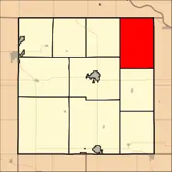 Location in Brown County | |
| Coordinates: 39°56′15″N 095°24′31″W / 39.93750°N 95.40861°W | |
| Country | United States |
| State | Kansas |
| County | Brown |
| Area | |
| • Total | 53.01 sq mi (137.3 km2) |
| • Land | 52.99 sq mi (137.25 km2) |
| • Water | 0.02 sq mi (0.06 km2) 0.04% |
| Elevation | 991 ft (302 m) |
| Population (2000) | |
| • Total | 311 |
| • Density | 5.9/sq mi (2.3/km2) |
| GNIS feature ID | 0472788 |
Irving Township is a township in Brown County, Kansas, USA. As of the 2000 census, its population was 311.
The first white settlement at Irving Township was made in 1855.[1]
Geography
Irving Township covers an area of 53.01 square miles (137.3 km2) and contains no incorporated settlements. According to the USGS, it contains three cemeteries: Kenyon, Partlow and Tesson.
The stream of Lost Shirt Creek runs through this township.
References
External links
Municipalities and communities of Brown County, Kansas, United States | ||
|---|---|---|
| Cities | 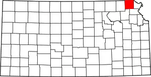 Map of Kansas highlighting Brown County | |
| Unincorporated communities | ||
| Indian reservations | ||
| Townships | ||
| Footnotes | †This community is designated a Census-Designated Place (CDP) by the United States Census Bureau. ‡This community also has portions in an adjacent county or counties. | |
This article is issued from Wikipedia. The text is licensed under Creative Commons - Attribution - Sharealike. Additional terms may apply for the media files.