Isla de Pascua
Rapa Nui | |
|---|---|
 Flag  Coat of arms | |
 | |
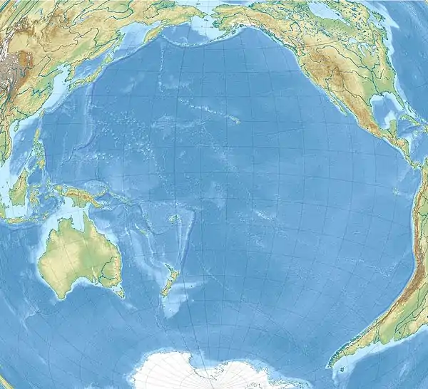 Isla de Pascua Easter Island in the Pacific Ocean | |
| Coordinates: 27°7′S 109°22′W / 27.117°S 109.367°W | |
| Country | Chile |
| Region | Valparaíso |
| Province | Isla de Pascua |
| Created | February 22, 1966 |
| Seat | Hanga Roa |
| Government | |
| • Type | Municipality |
| • Body | Municipal council |
| • Alcalde | Pedro Edmunds Paoa (PRO) |
| Area | |
| • Total | 163.6 km2 (63.2 sq mi) |
| Highest elevation | 507 m (1,663 ft) |
| Lowest elevation | 0 m (0 ft) |
| Population (2017 census) | |
| • Total | 7,750[2] |
| Time zone | UTC−6 (CLT) |
| • Summer (DST) | UTC−5 (CLST) |
| Country Code | +56 |
| Currency | Peso (CLP) |
| Language | Spanish, Rapa Nui |
| Driving side | right |
| Website | http://www.municipalidaddeisladepascua.cl |
| NGA UFI=-905269 | |
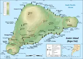
Isla de Pascua (Easter Island; Rapa Nui) is a Chilean commune with a special regime,[note 1] located within Isla de Pascua Province in Valparaíso Region. It is the only commune in Isla de Pascua Province, comprising Easter Island and Isla Salas y Gómez. Its capital is Hanga Roa, located in the southwestern area of the main island, where most of the local population resides.
Local government
The municipality of Isla de Pascua is led by mayor Pedro Edmunds Paoa (PRO), who is accompanied in the Municipal Council by:
Notes
- ↑ Although the Constitution establishes the commune of Isla de Pascua has a special regime, the organic law supposed to regulate the area has not yet been dictated.
References
- ↑ "Censo de Población y Vivienda 2002". National Statistics Institute. Archived from the original on 15 July 2010. Retrieved 1 May 2010.
- ↑ "Censo 2017". National Statistics Institute (in Spanish). Archived from the original on 11 May 2018. Retrieved 11 May 2018.
External links
| Culture |
| | ||||
|---|---|---|---|---|---|---|
| Geography and geology | ||||||
| Administration |
| |||||

This article is issued from Wikipedia. The text is licensed under Creative Commons - Attribution - Sharealike. Additional terms may apply for the media files.