| Itacaiúnas River | |
|---|---|
 | |
| Location | |
| Country | Brazil |
| State | Pará |
| Physical characteristics | |
| Mouth | Tocantins River |
• coordinates | 5°21′15″S 49°08′45″W / 5.35417°S 49.14583°W |
| Length | 600 km (370 mi) |
| Basin size | 41,418 km2 (15,992 sq mi)[1] |
| Discharge | |
| • location | Mouth |
| • average | 750 m3/s (26,000 cu ft/s)[2] |
| Basin features | |
| River system | Tocantins basin |
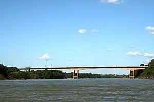
The Itacaiúnas River is a river of Pará state in north-central Brazil.
Part of the river basin is in the Tapirapé-Aquiri National Forest, a 196,504 hours (707,410 ks) sustainable use conservation unit created in 1989.[3]
See also
References
- ↑ Silva, Marcio Sousa da; Cavalcante, Rosane Lopes; Souza Filho, Pedro Walfir Martins e.; Silva Júnior, Renato Oliveira da; Pontes, Paulo Rógenes; Dallagnol, Roberto; Rocha, Edson José Paulino da (2021). "Comparison of sediment rating curves and sediment yield in subbasins of the Itacaiúnas River Watershed, Eastern Amazon". RBRH. 26. doi:10.1590/2318-0331.2621202100009. S2CID 236784646.
- ↑ Silva, Marcio Sousa da; Cavalcante, Rosane Lopes; Souza Filho, Pedro Walfir Martins e.; Silva Júnior, Renato Oliveira da; Pontes, Paulo Rógenes; Dallagnol, Roberto; Rocha, Edson José Paulino da (2021). "Comparison of sediment rating curves and sediment yield in subbasins of the Itacaiúnas River Watershed, Eastern Amazon". RBRH. 26. doi:10.1590/2318-0331.2621202100009. S2CID 236784646.
- ↑ FLONA do Tapirapé-Aquiri (in Portuguese), ISA: Instituto Socioambiental, retrieved 2016-05-30
This article is issued from Wikipedia. The text is licensed under Creative Commons - Attribution - Sharealike. Additional terms may apply for the media files.