Ivanić-Grad | |
|---|---|
| Grad Ivanić-Grad Town of Ivanić-Grad | |
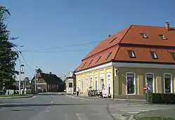
 Ivanić-Grad town center | |
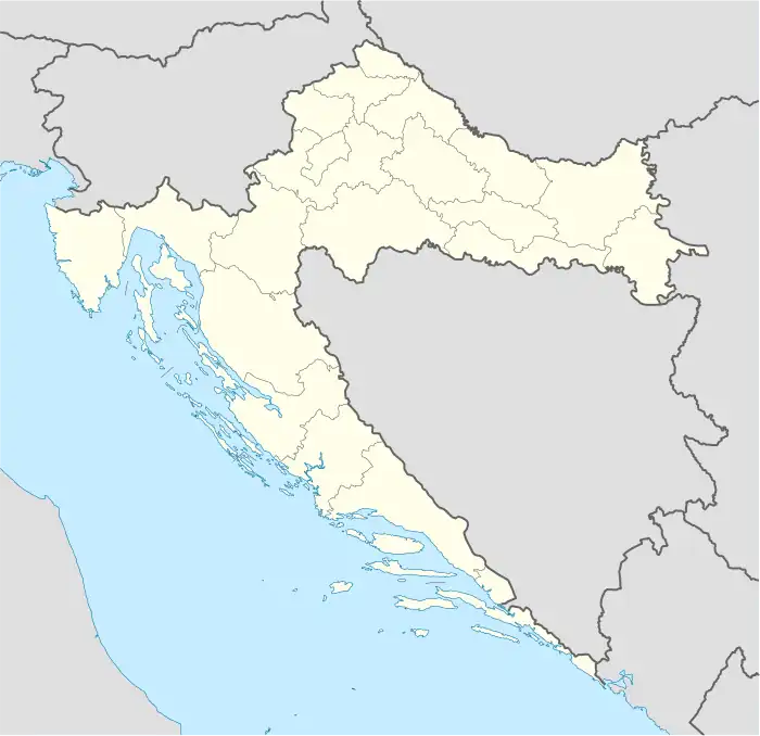
 Ivanić-Grad Location of Ivanić-Grad in Croatia | |
| Coordinates: 45°43′N 16°23′E / 45.71°N 16.39°E | |
| Country | |
| County | |
| Government | |
| • Mayor | Javor Bojan Leš (HDZ) |
| Area | |
| • Town | 173.5 km2 (67.0 sq mi) |
| • Urban | 45.3 km2 (17.5 sq mi) |
| Population (2021)[2] | |
| • Town | 12,982 |
| • Density | 75/km2 (190/sq mi) |
| • Urban | 8,452 |
| • Urban density | 190/km2 (480/sq mi) |
| Time zone | UTC+1 (CET) |
| • Summer (DST) | UTC+2 (CEST) |
| Postal code | 10310 |
| Area code | 01 |
| Website | ivanic-grad |
Ivanić-Grad or Ivanić Grad (pronounced [ǐʋanitɕ ɡrâːd]) is a town in Zagreb County, Croatia. It is on the border of Moslavina and Posavina.
Geography
Ivanić-Grad is located south-east from Zagreb, connected:
- 25 km (16 mi) by highway A3 (Bregana-Zagreb-Ivanić-Grad-Slavonski Brod-Lipovac)
- 25 km (16 mi) by train on direction Zagreb - Slavonski Brod - Vinkovci.
Population
In the 2011 census, the total population is 14,548, in the following settlements:[3]
- Caginec, population 555
- Deanovec, population 536
- Derežani, population 246
- Graberje Ivanićko, population 664
- Greda Breška, population 156
- Ivanić-Grad, population 9,379
- Lepšić, population 46
- Lijevi Dubrovčak, population 351
- Opatinec, population 321
- Posavski Bregi, population 816
- Prečno, population 98
- Prerovec, population 98
- Šemovec Breški, population 85
- Šumećani, population 494
- Tarno, population 57
- Topolje, population 112
- Trebovec, population 347
- Zaklepica, population 88
- Zelina Breška, population 99
In the 2011 census, 97% of the population were Croats.[4]
| population | 8401 | 8569 | 8794 | 10039 | 10701 | 11198 | 10724 | 10810 | 10168 | 10969 | 11274 | 12112 | 12859 | 13494 | 14723 | 14548 | 12982 |
| 1857 | 1869 | 1880 | 1890 | 1900 | 1910 | 1921 | 1931 | 1948 | 1953 | 1961 | 1971 | 1981 | 1991 | 2001 | 2011 | 2021 |
Administration
City government, court, police, health-service, post office are the part of infrastructure of Ivanić-Grad. Ivanić-Grad also has a well-known spa resort, Naftalan.
History
Ivanić-Grad was a border post between the Habsburg monarchy and the Ottoman Empire. In Habsburg Latin sources, it was known as Iwanych.[5]
Until 1918, Ivanić-Grad was part of the Austrian monarchy (Kingdom of Croatia-Slavonia after the compromise of 1867), in the Croatian Military Frontier.
Notable people
- Juraj Krnjević was one of the principal leaders of the Croatian Peasant Party (HSS) wholly devoted to achieving Croatian democracy and freedom.
- Đuro Deželić, writer
Education
There are 2 elementary schools (OŠ Stjepana Basaričeka and OŠ Đure Deželića) and a high school (SŠ Ivan Švear) in Ivanić-Grad.[6]
OŠ Đure Deželića has the status of an international eco-school and has a green flag.
References
- ↑ Register of spatial units of the State Geodetic Administration of the Republic of Croatia. Wikidata Q119585703.
- ↑ "Population by Age and Sex, by Settlements, 2021 Census". Census of Population, Households and Dwellings in 2021. Zagreb: Croatian Bureau of Statistics. 2022.
- ↑ "Population by Age and Sex, by Settlements, 2011 Census: Ivanić-Grad". Census of Population, Households and Dwellings 2011. Zagreb: Croatian Bureau of Statistics. December 2012.
- ↑ "Population by Ethnicity, by Towns/Municipalities, 2011 Census: County of Zagreb". Census of Population, Households and Dwellings 2011. Zagreb: Croatian Bureau of Statistics. December 2012.
- ↑ Monumenta spectantia historiam slavorum meridionalium. Academia Scientiarum et Artium Slavorum Meridionalium. 1917.
- ↑ "Škole i Učenički dom - Ivanić Grad online".
45°42′29″N 16°23′41″E / 45.70806°N 16.39472°E
