Jagadishpur | |
|---|---|
Census Town | |
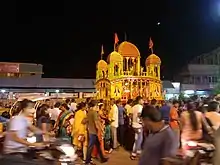
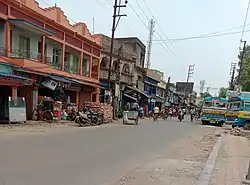 A view of Jagadishpur Hat | |
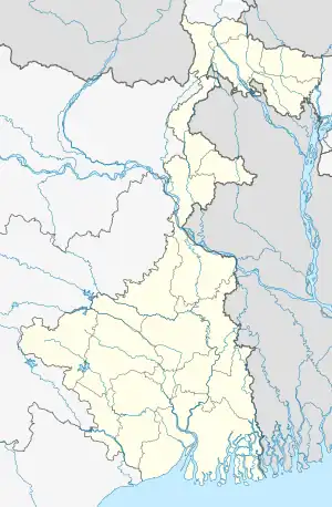 Jagadishpur Location in West Bengal, India  Jagadishpur Jagadishpur (India) | |
| Coordinates: 22°39′N 88°17′E / 22.65°N 88.29°E | |
| Country | |
| State | West Bengal |
| District | Howrah |
| Population (2011) | |
| • Total | 25,360 |
| Languages | |
| • Official | Bengali, English |
| Time zone | UTC+5:30 (IST) |
| Vehicle registration | WB |
| Lok Sabha constituency | Sreerampur |
| Vidhan Sabha constituency | Domjur |
| Website | howrah |
Jagadishpur is a census town in Bally Jagachha CD Block of Howrah Sadar subdivision in Howrah district in the Indian state of West Bengal. It is a part of Kolkata Urban Agglomeration.[1]
Jagadishpur is under the jurisdiction of Liluah Police Station of Howrah City Police.
Geography
Jagadishpur is located at 22°39′N 88°17′E / 22.65°N 88.29°E.[2]
Demographics

As per 2011 Census of India Jagadishpur had a total population of 16,259, of which 8,337 (51%) were males and 7,922 (49%) were females. Population below 6 years was 1,634. The total number of literates in Jagdishpur was 12,498 (85.46% of the population over 6 years).[3]
Transport

Benaras Road (part of State Highway 15) is the artery of the town. Besides Domjur-Jagadishpur Road connects the locality with Domjur.
Bus
Private Bus
- 57A (Chanditala — Howrah Station)
Mini Bus
- 30 (Baluhati — Esplanade)
Train
Kona railway station is the nearest railway station on Howrah-Amta line. The nearest railway junction is Dankuni railway station on Howrah-Bardhaman chord line.
References
- ↑ "District-wise list of stautory towns". Census Commission of India. Archived from the original on 25 April 2009. Retrieved 28 January 2009.
- ↑ "Yahoo maps location of Jagadishpur". Yahoo maps. Retrieved 7 December 2008.
- ↑ "C.D. Block Wise Primary Census Abstract Data(PCA)". 2011 census: West Bengal – District-wise CD Blocks. Registrar General and Census Commissioner, India. Retrieved 11 May 2016.
External links
| Cities, municipal and census towns | |
|---|---|
| Locations other than cities and towns | |
| Villages | |
| Related topics |
|