| Jalovec | |
|---|---|
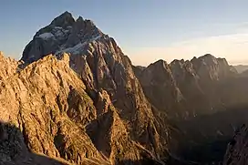
 The north face of Jalovec | |
| Highest point | |
| Elevation | 2,645 m (8,678 ft) |
| Prominence | 511 m (1,677 ft)[1] |
| Isolation | 2.74 km (1.70 mi) |
| Coordinates | 46°25′N 13°41′E / 46.417°N 13.683°E |
| Geography | |
 Jalovec Location in the Alps | |
| Location | Slovenia |
| Parent range | Julian Alps |

Mount Jalovec seen from Mount Sleme
Mount Jalovec (pronounced [ˈjaːlɔʋəts]; Italian: Monte Gialuz) is a mountain in the Julian Alps. With an elevation of 2,645 m, it is the sixth-highest peak in Slovenia.[2] It stands between the Tamar, Koritnica, and Trenta Alpine valleys. Nearby peaks include Mangart to the west, Travnik and Mojstrovka to the east, and Ponce to the north. The Log Cliff (Slovene: Loška stena, Italian: Parete di Bretto[3]) stands immediately southwest of Mount Jalovec.
Name
Mount Jalovec was attested in written sources as early as 1763–87 as Jellauz and Jelauz. The name is derived from the Slovene adjective jalov 'barren, infertile', referring to the lack of vegetation on the slopes of the mountain.[4]
See also
References
External links
 Media related to Jalovec at Wikimedia Commons
- "Jalovec - description and access routes". Hribi.net. Retrieved 2008-05-30.
- "Jalovec - maps and aerial photos". Geopedia.si. Geodetic Institute of Slovenia. Retrieved 2008-05-30.
This article is issued from Wikipedia. The text is licensed under Creative Commons - Attribution - Sharealike. Additional terms may apply for the media files.