| Jarbidge Peak | |
|---|---|
 Jarbidge Peak viewed from the ridge south of Bonanza Gulch | |
| Highest point | |
| Elevation | 10,799 ft (3,292 m) NAVD 88[1] |
| Prominence | 621 ft (189 m)[2] |
| Coordinates | 41°50′25″N 115°23′25″W / 41.840299903°N 115.390291556°W[1] |
| Geography | |
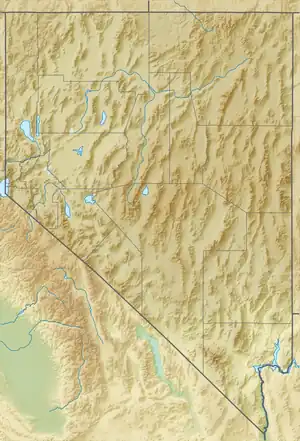
 Jarbidge Peak Nevada, U.S. | |
| Location | Elko County, Nevada, U.S. |
Jarbidge Peak is the second highest mountain in the Jarbidge Mountains of northern Elko County, Nevada, United States.[3] It is located within the Jarbidge Ranger District of the Humboldt-Toiyabe National Forest. The boundary of the Jarbidge Wilderness crosses the peak.[4]
"Jarbidge" is a name derived from the Shoshone language meaning "devil".[5] Indians believed the hills were haunted.[6]
Climate
| Climate data for Jarbidge Peak 41.8425 N, 115.3905 W, Elevation: 10,249 ft (3,124 m) (1991–2020 normals) | |||||||||||||
|---|---|---|---|---|---|---|---|---|---|---|---|---|---|
| Month | Jan | Feb | Mar | Apr | May | Jun | Jul | Aug | Sep | Oct | Nov | Dec | Year |
| Mean daily maximum °F (°C) | 25.3 (−3.7) |
25.3 (−3.7) |
30.3 (−0.9) |
35.0 (1.7) |
44.6 (7.0) |
55.2 (12.9) |
66.8 (19.3) |
66.0 (18.9) |
56.8 (13.8) |
43.5 (6.4) |
30.8 (−0.7) |
24.4 (−4.2) |
42.0 (5.6) |
| Daily mean °F (°C) | 17.9 (−7.8) |
16.8 (−8.4) |
20.6 (−6.3) |
24.7 (−4.1) |
33.7 (0.9) |
43.2 (6.2) |
53.8 (12.1) |
53.0 (11.7) |
44.2 (6.8) |
32.9 (0.5) |
22.9 (−5.1) |
17.1 (−8.3) |
31.7 (−0.2) |
| Mean daily minimum °F (°C) | 10.5 (−11.9) |
8.3 (−13.2) |
10.9 (−11.7) |
14.5 (−9.7) |
22.8 (−5.1) |
31.2 (−0.4) |
40.8 (4.9) |
40.0 (4.4) |
31.6 (−0.2) |
22.4 (−5.3) |
15.0 (−9.4) |
9.9 (−12.3) |
21.5 (−5.8) |
| Average precipitation inches (mm) | 5.34 (136) |
4.35 (110) |
4.97 (126) |
5.82 (148) |
5.28 (134) |
2.54 (65) |
1.11 (28) |
0.96 (24) |
1.48 (38) |
2.85 (72) |
4.29 (109) |
5.57 (141) |
44.56 (1,131) |
| Source: PRISM Climate Group[7] | |||||||||||||
Summit panorama
References
- 1 2 "Jarbidge". NGS Data Sheet. National Geodetic Survey, National Oceanic and Atmospheric Administration, United States Department of Commerce. Retrieved 2014-01-27.
- ↑ "Jarbridge Peak, Nevada". Peakbagger.com. Retrieved 2014-01-27.
- ↑ "Jarbidge Mountains". Peakbagger.com. Retrieved 2013-08-16.
- ↑ "Jarbidge Wilderness map". Wilderness.net. Retrieved 2013-08-16.
- ↑ Nestor, Sandy (29 November 2004). Indian Placenames in America. McFarland. p. 104. ISBN 978-0-7864-7167-6.
- ↑ Federal Writers' Project (1941). Origin of Place Names: Nevada (PDF). W.P.A. p. 25.
- ↑ "PRISM Climate Group, Oregon State University". PRISM Climate Group, Oregon State University. Retrieved October 2, 2023.
To find the table data on the PRISM website, start by clicking Coordinates (under Location); copy Latitude and Longitude figures from top of table; click Zoom to location; click Precipitation, Minimum temp, Mean temp, Maximum temp; click 30-year normals, 1991-2020; click 800m; click Retrieve Time Series button.
External links
- "Jarbidge Peak". Geographic Names Information System. United States Geological Survey, United States Department of the Interior. Retrieved August 16, 2013.
Wikimedia Commons has media related to Jarbidge Peak.
This article is issued from Wikipedia. The text is licensed under Creative Commons - Attribution - Sharealike. Additional terms may apply for the media files.
