Javornice | |
|---|---|
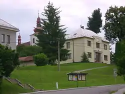 Municipal office and the Church of Saint George | |
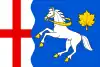 Flag 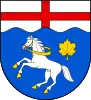 Coat of arms | |
 Javornice Location in the Czech Republic | |
| Coordinates: 50°10′17″N 16°20′58″E / 50.17139°N 16.34944°E | |
| Country | |
| Region | Hradec Králové |
| District | Rychnov nad Kněžnou |
| First mentioned | 1358 |
| Area | |
| • Total | 18.41 km2 (7.11 sq mi) |
| Elevation | 390 m (1,280 ft) |
| Population (2023-01-01)[1] | |
| • Total | 1,109 |
| • Density | 60/km2 (160/sq mi) |
| Time zone | UTC+1 (CET) |
| • Summer (DST) | UTC+2 (CEST) |
| Postal code | 517 11 |
| Website | www |
Javornice is a municipality and village in Rychnov nad Kněžnou District in the Hradec Králové Region of the Czech Republic. It has about 1,100 inhabitants.
Administrative parts
Villages of Jaroslav and Přím are administrative parts of Javornice.
References
External links
Wikimedia Commons has media related to Javornice.
This article is issued from Wikipedia. The text is licensed under Creative Commons - Attribution - Sharealike. Additional terms may apply for the media files.