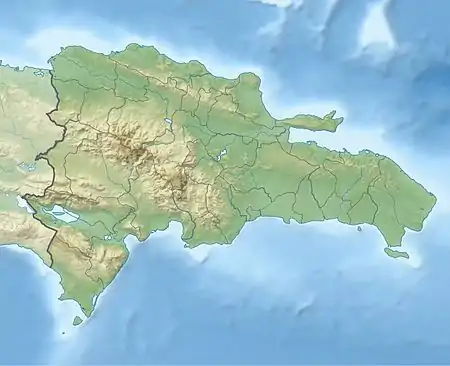
| Jayaco River Río Jayaco | |
|---|---|
 Jayaco River in Fula, Bonao, D.R. | |
 Location of mouth | |
| Location | |
| Country | Dominican Republic |
| Provinces | Monseñor Nouel |
| City | Sabana del Puerto |
| Physical characteristics | |
| Source | Cordillera Central |
| • location | Hoyo Redonda, Bonao, Monseñor Nouel, Dominican Republic |
| • coordinates | 19°6′5″N 70°31′14″W / 19.10139°N 70.52056°W |
| • elevation | 700 m (2,300 ft) |
| Mouth | Rincón Reservoir (Jima River) |
• location | Sabana del Puerto, Bonao, Monseñor Nouel, Dominican Republic |
• coordinates | 19°3′32″N 70°25′18″W / 19.05889°N 70.42167°W |
• elevation | 0 m (0 ft) |
| Length | 14.58 km (9.06 mi) |
| Basin features | |
| Tributaries | |
| • left | None |
| • right | None |
Jayaco River (Spanish: Río Jayaco) is a 14.58 km (9.06 mi)[1] long river in the Dominican Republic province of Monseñor Nouel. A part of the Yuna River watershed, the river originates in Hoyo Redonda within the Cordillera Central mountain range.[2] The river flows east from its source and reaches its mouth at the Rincón Reservoir (Spanish: Presa de Rincón), a part of the Jima River.[3]
References
- ↑ "Jayaco River course (length plotted using My Places Editor)". Bing Maps. Retrieved 2012-08-10.
- ↑ Google (2012-08-10). "Jayaco River source elevation" (Map). Google Maps. Google. Retrieved 2012-08-10.
- ↑ Google (2012-08-10). "Jayaco River mouth elevation" (Map). Google Maps. Google. Retrieved 2012-08-10.
This article is issued from Wikipedia. The text is licensed under Creative Commons - Attribution - Sharealike. Additional terms may apply for the media files.