Jianguomen Subdistrict
建国门街道 | |
|---|---|
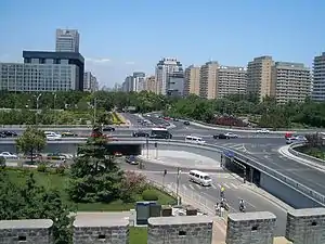
 View of Jianguomen Bridge within the subdistrict | |
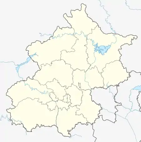
.png.webp) Location of Jianguomen Subdistrict within Dongcheng District | |
 Jianguomen Subdistrict  Jianguomen Subdistrict | |
| Coordinates: 39°54′37″N 116°26′11″E / 39.91028°N 116.43639°E | |
| Country | China |
| Municipality | Beijing |
| District | Dongcheng |
| Village-level Division | 9 communities |
| Area | |
| • Total | 2.7 km2 (1.0 sq mi) |
| Population (2020) | |
| • Total | 33,094 |
| • Density | 12,000/km2 (32,000/sq mi) |
| Time zone | UTC+8 (China Standard) |
| Postal code | 100005 |
| Area code | 010 |
Jianguomen Subdistrict (Chinese: 建国门街道; pinyin: jiànguómén jiēdào) is a subdistrict located in the eastern portion of the Dongcheng District, Beijing, China. It contains 9 residential communities within its 2.7 km2 area, and as of 2020 its totoal population is 33,094.[1]
The subdistrict is named after the Jianguomen, a gate on the eastern side of Beijing city wall that once stood in this region.
History
| Year | Status |
|---|---|
| 1912 | Part of 1st Inner District |
| 1949 | Part of Dongcheng District. Following subdistricts were created:
|
| 1955 | Reorganized into the following subdistricts:
|
| 1958 | The seven subdistricts merged into the Jianguomen Subdistrict |
| 1960 | Changed into a commune |
| 1990 | Restored as a subdistrict |
Administrative Division
In 2021, there are 9 communities within the subdistrict:[3]
| Administrative Division Code | Community Name in English | Community Name in Simplified Chinese |
|---|---|---|
| 110101008005 | Zhaojialou | 赵家楼 |
| 110101008006 | Xizongbu | 西总布 |
| 110101008007 | Dayabao | 大雅宝 |
| 110101008012 | Suzhou | 苏州 |
| 110101008014 | Waijiaobujie | 外交部街 |
| 110101008015 | Zhandong | 站东 |
| 110101008016 | Jinbaojie | 金宝街 |
| 110101008017 | Buzongbu | 东总布 |
| 110101008018 | Chongnei | 崇内 |
Local Landmarks
- Zhihua Temple
- Beijing Ancient Observatory
- Asbury Church
External links
References
- ↑ "China: Bĕijīng Municipal Province". CityPopulation.de. Citing: China National Bureau of Statistics (web), Bureaus of Statistics in Beijing (web). Retrieved 30 September 2020.
- ↑ Zhong hua ren min gong he guo zheng qu da dian. Bei jing shi juan. Li li guo, Li wan jun, Wu shi min, 李立国., 李万钧., 吴世民. Bei jing: Zhong guo she hui chu ban she. 2013. ISBN 978-7-5087-4058-4. OCLC 910451741.
{{cite book}}: CS1 maint: others (link) - ↑ "2021年统计用区划代码和城乡划分代码". www.stats.gov.cn. Retrieved 2022-09-17.
This article is issued from Wikipedia. The text is licensed under Creative Commons - Attribution - Sharealike. Additional terms may apply for the media files.