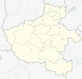
Jiushan
鸠山镇 | |
|---|---|
 Jiushan | |
| Coordinates: 34°13′11″N 113°10′13″E / 34.21972°N 113.17028°E | |
| Country | China |
| Province | Henan |
| Prefecture-level city | Xuchang |
| County-level city | Yuzhou |
| Area | |
| • Total | 93 km2 (36 sq mi) |
| Population (2019) | |
| • Total | 36,000 |
| • Density | 390/km2 (1,000/sq mi) |
Jiushan (simplified Chinese: 鸠山镇; traditional Chinese: 鳩山鎮; pinyin: Jiūshān Zhèn) is a town in the western portion of Yuzhou, Xuchang, Henan, China.[1][2] The town spans an area of 93 square kilometres (36 sq mi), and has a population of about 36,000.[2]
History
During the Song dynasty, Jiushan was home to a number of porcelain kilns.[2] Ruins of some of the kilns remain today, and are a tourist attraction.[2]
The town was home to Jiushan Red University (Chinese: 鸠山红专大学),[2] a Communist Party-run school where Party members went to receive ideological training and learn survival skills.[3] The now-delipidated ruins of the school remain, and are a red tourist attraction.[2][3]
Geography
Jiushan is located in western Yuzhou, bordered by Fangshan (Chinese: 方山镇) and Wenshu (Chinese: 文殊镇) to its east, Mojie Township (Chinese: 磨街乡) to its south, the county-level city of Ruzhou to its west, and the county-level city of Dengfeng to its north.[2]
Administrative divisions
Jiushan administers 31 administrative villages (Chinese: 行政村; pinyin: xíngzhèng cūn).[4]
|
|
|
Economy
Jiushan has 28,000 mu of arable land.[2]
Transportation
References
- ↑ 2021年统计用区划代码(禹州市) [2021 Statistical Division Codes (Yuzhou)] (in Chinese). National Bureau of Statistics of China. 2021. Archived from the original on 2022-01-04. Retrieved 2022-01-04.
- 1 2 3 4 5 6 7 8 9 鸠山镇 [Jiushan] (in Chinese). Yuzhou Municipal People's Government. 2020-03-13. Archived from the original on 2021-11-23. Retrieved 2022-01-04.
- 1 2 踏寻历史足迹 赓续红色精神---许昌市社会福利院开展党史学习教育 [Follow the historical footprint and continue the red spirit---Xuchang Social Welfare Institute launches party history learning and education] (in Chinese). Xuchang Bureau of Civil Affairs. 2021-05-07. Archived from the original on 2022-01-04. Retrieved 2022-01-04.
- ↑ 2021年统计用区划代码和城乡划分代码(鸠山镇) [2021 Statistical Division Codes and Urban-rural Division Codes (Jiushan)] (in Chinese). National Bureau of Statistics of China. 2021. Archived from the original on 2022-01-04. Retrieved 2022-01-04.