Jolanda di Savoia | |
|---|---|
| Comune di Jolanda di Savoia | |
.JPG.webp) | |
 Flag  Coat of arms | |
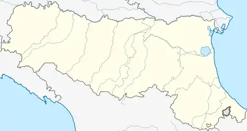
Location of Jolanda di Savoia | |
 Jolanda di Savoia Location of Jolanda di Savoia in Italy  Jolanda di Savoia Jolanda di Savoia (Emilia-Romagna) | |
| Coordinates: 44°53′N 11°59′E / 44.883°N 11.983°E | |
| Country | Italy |
| Region | Emilia-Romagna |
| Province | Ferrara (FE) |
| Government | |
| • Mayor | Paolo Pezzolato |
| Area | |
| • Total | 108.1 km2 (41.7 sq mi) |
| Elevation | −1 m (−3 ft) |
| Population | |
| • Total | 2,877 |
| • Density | 27/km2 (69/sq mi) |
| Demonym | Jolandini |
| Time zone | UTC+1 (CET) |
| • Summer (DST) | UTC+2 (CEST) |
| Postal code | 44037 |
| Dialing code | 0532 |
| Website | Official website |
Jolanda di Savoia (Ferrarese: Jôlánda) is a comune (municipality) in the Province of Ferrara in the Italian region Emilia-Romagna, located about 70 kilometres (43 mi) northeast of Bologna and about 30 kilometres (19 mi) east of Ferrara. Founded as Le Venezie in 1903, it took its current name (from that of Princess Yolanda of Savoy) in 1911.
Jolanda di Savoia borders the following municipalities: Berra, Codigoro, Copparo, Fiscaglia, Formignana, Tresigallo.
References
- ↑ "Superficie di Comuni Province e Regioni italiane al 9 ottobre 2011". Italian National Institute of Statistics. Retrieved 16 March 2019.
- ↑ Data from Istat
- ↑ "Popolazione Residente al 1° Gennaio 2018". Italian National Institute of Statistics. Retrieved 16 March 2019.
External links
Wikimedia Commons has media related to Jolanda di Savoia.
This article is issued from Wikipedia. The text is licensed under Creative Commons - Attribution - Sharealike. Additional terms may apply for the media files.