Juradó | |
|---|---|
Municipality and town | |
.svg.png.webp) Flag | |
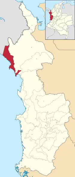 Location of the municipality and town of Juradó in the Chocó Department of Colombia. | |
| Country | |
| Department | Chocó Department |
| Area | |
| • Total | 992 km2 (383 sq mi) |
| Time zone | UTC-5 (Colombia Standard Time) |
Juradó (Spanish pronunciation: [xuɾaˈðo]) is the most northwestern municipality and town in Chocó Department, Colombia. It borders on Panama and on the Pacific Ocean.
Climate
Juradó has a tropical monsoon climate (Am in the Köppen climate classification) with moderate rainfall from January to March and heavy to very heavy rainfall in the remaining months. The following climate data is for the town of Juradó.
| Climate data for Juradó | |||||||||||||
|---|---|---|---|---|---|---|---|---|---|---|---|---|---|
| Month | Jan | Feb | Mar | Apr | May | Jun | Jul | Aug | Sep | Oct | Nov | Dec | Year |
| Mean daily maximum °C (°F) | 31.1 (88.0) |
31.7 (89.1) |
31.6 (88.9) |
31.5 (88.7) |
30.4 (86.7) |
30.2 (86.4) |
30.3 (86.5) |
30.1 (86.2) |
29.7 (85.5) |
29.2 (84.6) |
29.7 (85.5) |
30.0 (86.0) |
30.5 (86.8) |
| Daily mean °C (°F) | 26.4 (79.5) |
26.7 (80.1) |
27.1 (80.8) |
27.2 (81.0) |
26.6 (79.9) |
26.4 (79.5) |
26.5 (79.7) |
26.3 (79.3) |
26.1 (79.0) |
25.7 (78.3) |
25.9 (78.6) |
26.1 (79.0) |
26.4 (79.6) |
| Mean daily minimum °C (°F) | 21.8 (71.2) |
21.8 (71.2) |
22.6 (72.7) |
23.0 (73.4) |
22.9 (73.2) |
22.7 (72.9) |
22.7 (72.9) |
22.5 (72.5) |
22.5 (72.5) |
22.3 (72.1) |
22.2 (72.0) |
22.3 (72.1) |
22.4 (72.4) |
| Average precipitation mm (inches) | 58 (2.3) |
50 (2.0) |
70 (2.8) |
181 (7.1) |
446 (17.6) |
412 (16.2) |
429 (16.9) |
440 (17.3) |
376 (14.8) |
635 (25.0) |
532 (20.9) |
311 (12.2) |
3,940 (155.1) |
| Source: Climate-Data.org[1] | |||||||||||||
References
- ↑ "Climate: Juradó". Climate-Data.org. Retrieved July 28, 2020.
7°06′41″N 77°46′17″W / 7.11139°N 77.7714°W
This article is issued from Wikipedia. The text is licensed under Creative Commons - Attribution - Sharealike. Additional terms may apply for the media files.