| Kāohikaipu | |
|---|---|
 Kāohikaipu as seen from Oahu, some of Mānana Island can be seen on the left | |
| Highest point | |
| Elevation | 10 m (33 ft) |
| Prominence | 10 m (33 ft) |
| Coordinates | 21°19′13″N 157°39′23″W / 21.32028°N 157.65639°W |
| Geography | |
 Kāohikaipu | |
| Geology | |
| Mountain type | Tuff cone |
| Last eruption | Unknown |
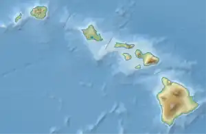
Kāohikaipu (also known as Black Rock)[1] is an islet located in Honolulu County, Hawaii, off the east coast of Oahu. It is situated 0.6 miles (0.52 nmi; 0.97 km) from nearby Mānana Island (Rabbit Island).[2][3] Both Kāohikaipu and Mānana Island are northeast of Makapuʻu Point. The total size of Kāohikaipu is 11 acres (4.5 ha).[3][4]
Kāohikaipu′s formation was due to the Honolulu Volcanic Series, which were a series of eruptions by the Koʻolau Range that created numerous vents near Honolulu such as Diamond Head.
The islet is a wildlife sanctuary for birds[3] and a permit is needed for people to access it.[4]
See also
References
- ↑ Cazar, Allen. "The Story of the Mysterious Islands Off Oahu - Get2Hawaii ®". Retrieved 2020-08-06.
- ↑ "Kāohikaipu Island, Honolulu County, Hawaii, United States". www.mindat.org. Retrieved 2020-08-06.
- 1 2 3 "Kaohikaipu State Wildlife Sanctuary | Oahu Forestry and Wildlife Program". hbmpweb.pbrc.hawaii.edu. Archived from the original on 2021-05-03. Retrieved 2020-08-06.
- 1 2 "Offshore Islet Project". www2.bishopmuseum.org. Retrieved 2020-08-06.
This article is issued from Wikipedia. The text is licensed under Creative Commons - Attribution - Sharealike. Additional terms may apply for the media files.