Kılan
Aktoprak | |
|---|---|
_copy.jpg.webp) | |
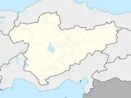
 Kılan Location in Turkey  Kılan Kılan (Turkey Central Anatolia) | |
| Coordinates: 37°28′52″N 34°27′55″E / 37.48111°N 34.46528°E | |
| Country | Turkey |
| Province | Niğde |
| District | Ulukışla |
| Elevation | 1,519 m (4,984 ft) |
| Population (2022) | 1,596 |
| Time zone | TRT (UTC+3) |
| Postal code | 51910 |
| Area code | 0388 |
Kılan (also known as Aktoprak) is a village in Ulukışla District, Niğde Province, Turkey.[1] Its population is 1,596 (2022).[2] Before the 2013 reorganisation, it was a town (belde).[3]
Probably the earliest settlement was established during the Roman Empire era. About 250 years ago, during the Ottoman Empire era, a Turkmen tribe named Kılanoğulları ('sons of Kılan') settled around the village.[4] In 1989 the municipality of Kılan was established and Kılan was declared a belde ('seat of township') . However in 2015 the municipality was disestablished.[4]
The main economic activity is agriculture and animal husbandry. The main crop is cherry.
References
- ↑ Köy, Turkey Civil Administration Departments Inventory. Retrieved 1 March 2023.
- ↑ "Address-based population registration system (ADNKS) results dated 31 December 2022, Favorite Reports" (XLS). TÜİK. Retrieved 13 March 2023.
- ↑ Law No. 6360, Official Gazette, 6 December 2012 (in Turkish).
- 1 2 "Ulukışla municipality page" (in Turkish). Archived from the original on 2018-03-03. Retrieved 2018-11-13.
This article is issued from Wikipedia. The text is licensed under Creative Commons - Attribution - Sharealike. Additional terms may apply for the media files.