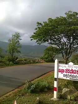
Kaduru
Kadur | |
|---|---|
Town | |
 Kadur | |
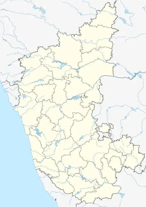 Kaduru Location in Karnataka, India | |
| Coordinates: 13°33′12″N 76°00′41″E / 13.553345°N 76.011260°E | |
| Country | |
| State | Karnataka |
| District | Chikkamagaluru |
| Area | |
| • Town | 10.3 km2 (4.0 sq mi) |
| • Rural | 1,414 km2 (546 sq mi) |
| Elevation | 763 m (2,503 ft) |
| Population (2011) | |
| • Town | 34,151 |
| • Density | 3,300/km2 (8,600/sq mi) |
| • Rural | 291,668[1] |
| Languages | |
| • Official | Kannada |
| Time zone | UTC+5:30 (IST) |
| PIN | 577548 |
| Vehicle registration | KA-66 & KA-18 |
| Website | http://www.kadurtown.mrc.gov.in |
Kaduru, also known as Kadur, is second largest town in the district and a Taluk in Chikkamagaluru district, in Karnataka. It is located at 13°33′12″N 76°00′41″E / 13.553345°N 76.011260°E[2] in the rain shadow region of western ghats. Most of the taluk is dry, unlike much of the district. Kadur is known for Areca nut and also Coconut production.
It is now, the second largest town in the district and also the former capital of Kadur district. The capital was moved to Chikmagalur in 1865, but the district name remained. Later in 1947, the district was renamed as Chikmagalur district. [3]
Demographics
As of 2001 India census,[4] Kadur had a population of 35436. Males constitute 51% of the population and females 49%. Kadur has an average literacy rate of 68%, higher than the national average of 59.5%: male literacy is 73%, and female literacy is 63%. In Kadur, 12% of the population is under 6 years of age.
Geography
Kadur is located in the eastern part of Chikkamagaluru district, which has a semi-arid climate. Its elevation is around 760metres above the mean sea level. It has a dry climate with annual rainfall less than 750 millimetres (30 in).
In 2022, Kadur hobli received an annual rainfall of 1,004 millimetres (39.5 in), which was excess by 57%. Meanwhile, both Sakharayapatna and Panchanahalli hoblis received 1,130 millimetres (44 in) of rainfall each; highest in Kadur taluk.[5]
Colleges in Kadur
- Government Pre-University College, B.H Road, Kadur-577548
- Government First Grade College, B.H Road, Kadur-577548
- Kuvempu university PG Center, Gedlehalli, B.H Road, Kadur-577548
Training schools in Kadur
- Police Training School, Gedlehalli, B.H Road, Kadur-577548
- Government Tool Room & Training Center, B.H Road, Kadur-577548
Nearby places
- Ayyanakere Lake: 22 km from Kadur town.
- Madagadakere Lake: 15 km away from Kadur town.
- Hirenalluru : 15 km north east of Kadur, Hirenalluru is known for the Mallikarjuna Temple built in 8th century by Gangas. Later the Hoysala king Ballala II renovated this temple.
- Mullayyanagiri: 67 km west of Kadur, Highest peak in Karnataka With a height of 1,925 metres (6,316 ft).
- Diamond falls: 26 km west of Kadur in Kamenahalli.
Transportation
- 24 hours bus service to Chikkamagaluru, Mangaluru, Dharmasthala, Bengaluru, Hubballi & Mysuru.
- Have trains to Shivamogga, Hubballi, Bengaluru, Mysuru, Mangaluru, Chikkamagaluru & also major Inter state Fast Express trains have their halts, either in Kadur Junction railway station or nearby (8kms) Birur Junction railway station.
- Nearest airport is Shivamogga Airport at 70kms and Mangaluru International Airport, Mangaluru at 180kms.
Roads
- NH-173 or "KM Road" to Mangaluru, via Chikmagalur and Mudigere.
- Shivamogga-Tumakuru 4-lane Highway towards Bengaluru & Mysuru, via Banavara
- SH 152 towards Belaguru & Huliyar
- SH 153 towards Hirenalluru & Shivani
Railway
Kadur Junction railway station belongs to Mysuru Division of South-western Railway Zone. It lies on Bengaluru-Hubballi line, which is a double-electrified line. Another line towards Shivamogga, bifurcates from Birur, which is 8kms northwest of Kadur. Technically, it became a Railway junction in 2013, when the Kadur-Chikkamagaluru line was opened for public.
References
- ↑ "Population finder". Retrieved 22 May 2023.
- ↑ Falling Rain Genomics, Inc - Kaduru
- ↑ "Kadur District" (PDF). Retrieved 19 April 2023.
- ↑ "Census of India 2001: Data from the 2001 Census, including cities, villages and towns (Provisional)". Census Commission of India. Archived from the original on 16 June 2004. Retrieved 1 November 2008.
- ↑ "Annual State Report 2022" (PDF). ksndmc.org. Retrieved 6 July 2023.
Transportation
- This article incorporates text from a publication now in the public domain: Chisholm, Hugh, ed. (1911). "Kadur". Encyclopædia Britannica (11th ed.). Cambridge University Press.