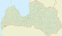
Kalēti Parish | |
|---|---|
 | |
| Country | Latvia |
| Area | |
| • Total | 79.77 km2 (30.80 sq mi) |
| • Land | 77.98 km2 (30.11 sq mi) |
| • Water | 1.79 km2 (0.69 sq mi) |
| Population (1 January 2023)[2] | |
| • Total | 515 |
| • Density | 6.5/km2 (17/sq mi) |
Kalēti Parish (Latvian: Kalētu pagasts) is an administrative unit of South Kurzeme Municipality in the Courland region of Latvia. The parish has a population of 713 (as of 1/07/2013) and covers an area of 79.78 km2.
Villages of Kalēti parish
- Kalēti
- Meiri
- Ozoli
- Upesmuiža
External links
- Kalēti parish in Latvian
- ↑ "Reģionu, novadu, pilsētu un pagastu kopējā un sauszemes platība gada sākumā". Central Statistical Bureau of Latvia. Retrieved 18 January 2023.
- ↑ "Iedzīvotāju skaits pēc tautības reģionos, pilsētās, novados, pagastos, apkaimēs un blīvi apdzīvotās teritorijās gada sākumā (pēc administratīvi teritoriālās reformas 2021. gadā) 2021 - 2022". Central Statistical Bureau of Latvia. Retrieved 3 October 2023.
This article is issued from Wikipedia. The text is licensed under Creative Commons - Attribution - Sharealike. Additional terms may apply for the media files.