Kalaznó | |
|---|---|
 Kalaznó | |
| Coordinates: 46°30′04″N 18°28′33″E / 46.50111°N 18.47583°E | |
| Country | |
| County | Tolna |
| Area | |
| • Total | 18.3 km2 (7.1 sq mi) |
| Population (2011) | |
| • Total | 167 |
| • Density | 9.1/km2 (24/sq mi) |
| Time zone | UTC+1 (CET) |
| • Summer (DST) | UTC+2 (CEST) |
| Postal code | 7194 |
| Area code | 74 |
Kalaznó
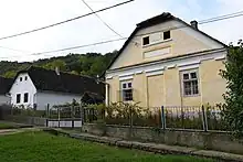
Kalaznó is a village in Tolna county, Hungary.
| City with county rights |
|   |
|---|---|---|
| Towns | ||
| Large villages | ||
| Villages |
| |
| Other topics |
| |
This article is issued from Wikipedia. The text is licensed under Creative Commons - Attribution - Sharealike. Additional terms may apply for the media files.