Kami
香美市 | |
|---|---|
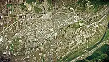
.jpg.webp) View of Kami | |
 Flag  Emblem | |
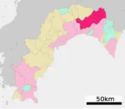
Location of Kami in Kōchi Prefecture | |
 | |
 Kami Location in Japan | |
| Coordinates: 33°36′N 133°41′E / 33.600°N 133.683°E | |
| Country | Japan |
| Region | Shikoku |
| Prefecture | Kōchi |
| Government | |
| • Mayor | Koichiro Yorimitsu |
| Area | |
| • Total | 537.86 km2 (207.67 sq mi) |
| Population (July 1, 2022) | |
| • Total | 25,562 |
| • Density | 48/km2 (120/sq mi) |
| Time zone | UTC+09:00 (JST) |
| City hall address | 1-chome, Takaramachi, Tosayamada-cho, Kami-shi, Kochi-ken782-0034 |
| Climate | Cfa |
| Website | Official website |


Kami (香美市, Kami-shi) is a city located in Kōchi Prefecture, Japan. As of 1 July 2022, the city had an estimated population of 25,562 in 13212 households and a population density of 48 persons per km².[1]The total area of the city is 537.86 square kilometres (207.67 sq mi).
Geography
Kami is located in the eastern part of Kōchi Prefecture. It is the only city in Kōchi prefecture that does not face the sea.
Neighbouring municipalities
Kōchi Prefecture
Tokushima Prefecture
Climate
The climate in the region is warm and temperate, with significant rainfall throughout the year, even in the driest months. January is considered the month with the least amount of rainfall, around 73.0 mm (2.87 in). July is the wettest month, with an average of 473.9 mm (18.66 in). The average annual rainfall is around 2,981.9 mm (117.40 in).[2]
The average annual temperature is 15.2 °C (59.4 °F). August is the warmest month, with an average temperature of 26.0 °C (78.8 °F), and January is the coldest month, reaching an average of 4.6 °C (40.3 °F). According to the Köppen and Geiger climate classification, the climate in that locality is classified as Cfa (humid subtropical climate).[2]
| Climate data for Kami (1991−2020 normals, extremes 1977−present) | |||||||||||||
|---|---|---|---|---|---|---|---|---|---|---|---|---|---|
| Month | Jan | Feb | Mar | Apr | May | Jun | Jul | Aug | Sep | Oct | Nov | Dec | Year |
| Record high °C (°F) | 19.1 (66.4) |
22.7 (72.9) |
25.2 (77.4) |
29.4 (84.9) |
32.0 (89.6) |
34.2 (93.6) |
37.4 (99.3) |
38.5 (101.3) |
35.6 (96.1) |
30.5 (86.9) |
24.8 (76.6) |
22.3 (72.1) |
38.5 (101.3) |
| Mean daily maximum °C (°F) | 9.7 (49.5) |
11.1 (52.0) |
14.8 (58.6) |
20.1 (68.2) |
24.5 (76.1) |
26.8 (80.2) |
30.7 (87.3) |
31.9 (89.4) |
28.4 (83.1) |
23.4 (74.1) |
17.5 (63.5) |
11.9 (53.4) |
20.9 (69.6) |
| Daily mean °C (°F) | 4.6 (40.3) |
5.6 (42.1) |
8.9 (48.0) |
13.8 (56.8) |
18.3 (64.9) |
21.6 (70.9) |
25.3 (77.5) |
26.0 (78.8) |
22.8 (73.0) |
17.4 (63.3) |
11.7 (53.1) |
6.5 (43.7) |
15.2 (59.4) |
| Mean daily minimum °C (°F) | 0.5 (32.9) |
1.2 (34.2) |
3.9 (39.0) |
8.4 (47.1) |
13.0 (55.4) |
17.6 (63.7) |
21.5 (70.7) |
22.0 (71.6) |
18.8 (65.8) |
12.9 (55.2) |
7.2 (45.0) |
2.4 (36.3) |
10.8 (51.4) |
| Record low °C (°F) | −7.2 (19.0) |
−7.1 (19.2) |
−4.2 (24.4) |
−0.6 (30.9) |
2.8 (37.0) |
8.1 (46.6) |
13.3 (55.9) |
14.6 (58.3) |
7.7 (45.9) |
2.6 (36.7) |
−1.1 (30.0) |
−4.3 (24.3) |
−7.2 (19.0) |
| Average precipitation mm (inches) | 73.0 (2.87) |
123.9 (4.88) |
189.0 (7.44) |
231.8 (9.13) |
260.1 (10.24) |
383.5 (15.10) |
473.9 (18.66) |
391.8 (15.43) |
395.6 (15.57) |
208.7 (8.22) |
123.5 (4.86) |
101.2 (3.98) |
2,981.9 (117.40) |
| Average precipitation days (≥ 1.0 mm) | 7.5 | 8.4 | 11.0 | 10.4 | 10.8 | 14.8 | 13.7 | 12.6 | 12.6 | 9.3 | 7.8 | 7.0 | 125.9 |
| Mean monthly sunshine hours | 156.9 | 153.5 | 176.0 | 193.0 | 193.2 | 130.0 | 152.9 | 178.3 | 146.9 | 167.8 | 154.2 | 154.8 | 1,957.4 |
| Source: Japan Meteorological Agency[3][2] | |||||||||||||
Demographics
Per Japanese census data, the population of Kami in 2020 is 26,513 people.[4] Kami has been conducting censuses since 1960.
| Year | Pop. | ±% |
|---|---|---|
| 1960 | 43,319 | — |
| 1965 | 39,238 | −9.4% |
| 1970 | 35,553 | −9.4% |
| 1975 | 34,482 | −3.0% |
| 1980 | 33,878 | −1.8% |
| 1985 | 34,016 | +0.4% |
| 1990 | 32,401 | −4.7% |
| 1995 | 31,076 | −4.1% |
| 2000 | 31,175 | +0.3% |
| 2005 | 30,257 | −2.9% |
| 2010 | 28,766 | −4.9% |
| 2015 | 27,513 | −4.4% |
| 2020 | 26,513 | −3.6% |
| Kami population statistics[4] | ||
History
As with all of Kōchi Prefecture, the area of Kami was part of ancient Tosa Province. During the Edo period, the area was part of the holdings of Tosa Domain ruled by the Yamauchi clan from their seat at Kōchi Castle. The area was organized into villages within Kami District with the creation of the modern municipalities system on April 1, 1889. The city of Kami was established on March 1, 2006,[5] from the merger of the towns of Kahoku and Tosayamada, and the village of Monobe. On the same day, the remaining municipalities of Kami District merged to form the city of Kōnan, and the district was abolished as a result.[6][7]
Government
Kami has a mayor-council form of government with a directly elected mayor and a unicameral town council of 20 members. Kami contributes one member to the Kōchi Prefectural Assembly. In terms of national politics, the city is part of Kōchi 1st district of the lower house of the Diet of Japan.
Economy
Kami's economy is centered on agriculture and forestry. The production of forged knives is a traditional local handicraft.
Education
Kami has seven public elementary schools and three public middle schools operated by the city government, and one public high school operated by the Kōchi Prefectural Board of Education. The Kochi University of Technology is located in Kami.
Transportation
Railway
Highways
International relations
Twin and sister cities
 Largo (United States Florida) (1969)
Local attractions


- Ryūga Cave, Natural Monument and National Historic Site
- TosaYamada stadium
- Yanase Takashi Memorial Hall
Noted people from Kami
- Takenori Emoto
- Keisuke Katto
- Yoshitaka Katori
- Yumiko Kurahashi (1935–2005), writer and antinovelist.
- Taira Hara, manga artist born in Tosayamada
- Takashi Yanase
See also
- Naming citation for asteroid 26097 Kamishi
References
- ↑ "Kami city official statistics" (in Japanese). Japan.
- 1 2 3 気象庁 / 平年値(年・月ごとの値). JMA. Retrieved April 19, 2022.
- ↑ 観測史上1~10位の値(年間を通じての値). JMA. Retrieved April 19, 2022.
- 1 2 Kami population statistics
- ↑ "高知県香美市 (39212A2006)". 歴史的行政区域データセットβ版. Retrieved 2019-12-16.
- ↑ "JALS -Japan Arteriosclerosis Longitudinal Study- : 参加コホート". jals.gr.jp. Retrieved 2019-12-16.
- ↑ "香美市が誕生! (Kami City is born!)" (PDF). March 1, 2006. Retrieved December 16, 2019.
External links
 Media related to Kami, Kōchi at Wikimedia Commons
- Kami City official website (in Japanese)

