| Kamor | |
|---|---|
 Kamor (left) and Hoher Kasten as seen from Appenzell | |
| Highest point | |
| Elevation | 1,751 m (5,745 ft)[1] |
| Prominence | 73 m (240 ft)[1] |
| Parent peak | Hoher Kasten |
| Isolation | 0.6 km (0.37 mi)[1] |
| Coordinates | 47°17′23″N 9°29′12″E / 47.28972°N 9.48667°E |
| Naming | |
| Pronunciation | Swiss German: [kxaˈmoːr] |
| Geography | |
 Kamor Kamor in the Alps | |
| Location | Switzerland |
| Parent range | Appenzell Alps |
The Kamor is a mountain in the Appenzell Alps and has an elevation of 1,751 m above the sea. It is part of a mountain belt which forms the western boundary of the Rhine Valley and is located on the border of the Swiss cantons Appenzell Innerrhoden and Canton of St. Gallen.
Less than one kilometre to the south is the Hoher Kasten, a 1,794 m high mountain accessible via an aerial tramway.[1] Both mountains are separated by the Kamorsattel, a 1,678 m high saddle.[1]

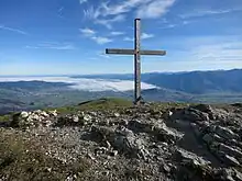
Summit cross and view direction Alpine Rhine and Lake Constance
On top of the Kamor is a wooden summit cross erected by the section Kamor of the Swiss Alpine Club.
Ascents to Kamor and Hoher Kasten were already described in the early 19th century.[2]
References
External links
 Media related to Kamor at Wikimedia Commons
- Interactive panoramic view
This article is issued from Wikipedia. The text is licensed under Creative Commons - Attribution - Sharealike. Additional terms may apply for the media files.