Lupak Luas
Kampung Lupak Luas | |
|---|---|
.jpg.webp) Lupas Luas on the foreground. | |
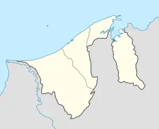
 Location in Brunei | |
| Coordinates: 4°52′11″N 114°56′26″E / 4.869716°N 114.940467°E | |
| Country | Brunei |
| District | Brunei-Muara |
| Mukim | Lumapas |
| Postcode | BJ2524 |
Kampong Lupak Luas (Malay: Kampung Lupak Luas) or simply known as Lupak Luas, is a village-level subdivision of Lumapas, a mukim (subdistrict) of Brunei-Muara District, Brunei. The postcode for the village is BJ2524.[1][2]
Name
Kampong Lupak Luas comes from the Malay name which translates as 'Lupak Luas Village'.
Transportation
Land
The village is connected by road named Jalan Sungai Assam.[3]
Infrastructure
A side path built on their own small branch of the Brunei River behind the bigger Kampong Burong Pingai Ayer, there are about a dozen water village dwellings in 2011.[3]
The village has a Chinese cemetery located on a private land (Lot 118,EDR 1267), which was to be gazetted as a cemetery that is not Islamic, overseen by the district government, and does not need tomb excavation or relocation in 2023.[4] In addition to this, an Islamic cemetery also sits in the village.[5]
The jogging track on Lupak Hill (Bukit Lupak) was finished on 25 May 2014, and it is now open for use.[6]
References
- ↑ "postcodes". post.gov.bn. Retrieved 27 August 2018.
- ↑ "Kampong Lupak Luas, Lumapas, Brunei Muara: BJ2524". brn.postcodebase.com. Retrieved 27 August 2018.
- 1 2 "Step into the Past at Kampong Lupak Luas". Retrieved 2023-12-03.
- ↑ "Officials visit Chinese cemetery » Borneo Bulletin Online". Officials visit Chinese cemetery. 2023-12-03. Retrieved 2023-12-03.
- ↑ Ibrahim, Haji (2012-03-07). "TANAH-TANAH PERKUBURAN ISLAM NEGARA BRUNEI DARUSSALAM: KAYU BESAR TUMBANG DI TANAH PERKUBURAN ISLAM KAMPONG LUPAK LUAS, MUKIM SUNGAI KEBUN". TANAH-TANAH PERKUBURAN ISLAM NEGARA BRUNEI DARUSSALAM. Retrieved 2023-12-03.
- ↑ Moktar, Hj Suhaili Hj (2014-05-24). "Aktiviti MPK Lupak Luas / Tarap Bau: MERINTIS/MEMBUKA TREK JOGGING BUKIT LUPAK LUAS". Aktiviti MPK Lupak Luas / Tarap Bau. Retrieved 2023-12-03.