Keihanna Science City
関西文化学術研究都市 けいはんな学研都市 | |
|---|---|
| Kansai Science City | |
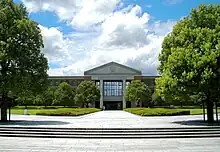
 Keihanna Plaza in Seika | |
| Coordinates: 34°44′42″N 135°45′54″E / 34.745°N 135.765°E | |
| Country | Japan |
| Region | Kansai |
| Prefectures | |
| Opened | October 1994 |
| Founded by | Azuma Okuda |
| Area | |
| • Total | 154.12 km2 (59.51 sq mi) |
| Population (April 1, 2021)[2] | |
| • Total | 253,729 |
| • Density | 1,600/km2 (4,300/sq mi) |
| Time zone | UTC+9 (JST) |
| Website | www |
Kansai Science City (関西文化学術研究都市, Kansai Bunka-gakujutsu-kenkyū-toshi) is an unincorporated city located in the Keihanna Hills (京阪奈丘陵, Keihanna kyūryō), a border region between Kyoto, Osaka, and Nara Prefectures in Kansai region, Japan. The name is commonly shortened[lower-alpha 1] to Keihanna Science City (けいはんな学研都市, Keihanna Gakken-toshi) or Gakken-toshi (学研都市). The name Keihanna is constructed by extracting a representative kanji from Kyoto, Osaka, and Nara. It is about 25 kilometers (16 mi) south of the city of Kyoto and 30 kilometers (19 mi) east of the city of Osaka. The city was constructed to help the advancement of creative arts, sciences, and research, as well as to spur the creation of new industries and cultures.
Location
| Year | Pop. | ±% |
|---|---|---|
| 1986 | 128,278 | — |
| 1991 | 171,805 | +33.9% |
| 1996 | 194,514 | +13.2% |
| 2001 | 212,826 | +9.4% |
| 2006 | 228,425 | +7.3% |
| 2011 | 241,020 | +5.5% |
| 2016 | 248,435 | +3.1% |
| 2021 | 253,729 | +2.1% |
| Source: [2] | ||
Kansai Science City is located in portions of the following eight cities (市, shi) and towns (町, chō), in three prefectures:
- Osaka Prefecture
- Hirakata (枚方市, Hirakata-shi)
- Katano (交野市, Katano-shi)
- Shijōnawate (四條畷市, Shijōnawate-shi)
- Kyoto Prefecture
- Kyōtanabe (京田辺市, Kyōtanabe-shi)
- Kizugawa (木津川市, Kizugawa-shi)
- Sōraku District (相楽郡, Sōraku-gun)
- Seika (精華町, Seika-chō)
- Nara Prefecture
Out of these, Seika in Kyoto Prefecture is completely inside the Kansai Science City.
The overall area of the Kansai Science City is 154 square kilometers (59 sq mi), with an estimated population of 250,000. There are 12 "Cultural and Academic Research Zones" within the Kansai Science City, encompassing 33 square kilometers (13 sq mi), with an estimated population of 100,000. Seika & Nishikizu is the central district of this city. Fugenji and Kita-Tawara are science districts in land use adjustment.
| Jurisdiction | Osaka Prefecture | Kyoto Prefecture | Nara Prefecture | Total | |||||
|---|---|---|---|---|---|---|---|---|---|
| Hirakata | Shijōnawate | Katano | Kyōtanabe | Seika | Kizugawa | Nara | Ikoma | ||
| Area | 15.10 km2 | 14.70 km2 | 15.50 km2 | 24.42 km2 | 25.68 km2 | 23.62 km2 | 14.60 km2 | 20.50 km2 | 154.12 km2 |
| Population | 33,244 | 11,382 | 14,515 | 22,126 | 58,079 | 37,024 | 52,403 | 24,956 | 253,729 |
| Cultural and Academic Research Zone | Himuro & Tsuda (0.74 km2) | Seika & Nishikizu (5.06 km2) | Takayama (3.33 km2) |
| |||||
| Kiyotaki & Muroike (3.40 km2) | Heijo & Soraku (6.26 km2) | ||||||||
| Tanabe (1.00 km2) | Kizu (7.37 km2) | ||||||||
| Minamitanabe & Komada (3.44 km2) | Heijo Palace Site (1.42 km2) | ||||||||
| Tawara (1.27 km2) | Fugenji | Kita-Tawara | |||||||
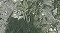
- Aerial photographs[3]
 Himuro & Tsuda
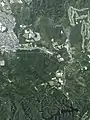 Kiyotaki & Muroike
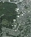 Tawara
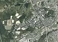 Tanabe
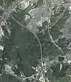 Minamitanabe & Komada
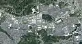 Seika & Nishikizu
 Heijo & Soraku
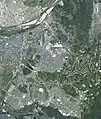 Kizu
Kizu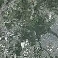 Takayama
 Heijo Palace Site
Main research institutes and universities
Universities
- Shijonawate Campus, Osaka Electro-Communication University
- Doshisha University - Kyotanabe Campus, Tatara Campus, and Gakken Toshi Campus
- Kyotanabe Campus, Doshisha Women's College of Liberal Arts
- Institute of Free electron laser (iFEL), Osaka University[4]
- Nara Institute of Science and Technology
- Seika Campus, Kyoto Prefectural University
- Experimental Farm, Kyoto University
Research institutes
- Universal Communication Research Institute, National Institute of Information and Communications Technology (NICT)
- Advanced Telecommunications Research Institute International (ATR)[5]
- Technology Research Laboratory, Shimadzu
- Keihanna Research Center, Kyocera - optical and electronic devices, solar cells, advanced thin-film technologies
- Kansai Photon Science Institute, National Institutes for Quantum and Radiological Science and Technology (QST)
- Keihanna Site, Panasonic
- Keihanna Technology Innovation Center, OMRON
- International Institute for Advanced Studies (IIAS)[6]
- Nara Research and Development Center, Santen Pharmaceutical
- Rohto Research Village Kyoto
- Kansai Electronic Industry Development Center - supported by the Ministry of Economy, Trade and Industry[7]
- Ion Technology Center
- Research Institute of Innovative Technology for the Earth (RITE) - supported by the Ministry of Economy, Trade and Industry[8]
- Keihanna Campus, Riken
- Suntory World Research Center
- Nidec Center for Industrial Science
- Keihanna Area, NTT Communication Science Laboratories
- Nara Research Institute for Cultural Properties
Other
- Kansai-kan of the National Diet Library
- Heijō Palace
- Keihanna Open Innovation Center @Kyoto (KICK)
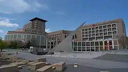
- Keihanna Plaza
Transportation
- Gakkentoshi Line, West Japan Railway Company (JR West)
- Nara Line (JR West)
- Kyoto Line, Kintetsu Railway (Kintetsu)
- Keihanna Line (Kintetsu)
- Shin-Meishin Expressway
- Second Keihan Highway
- Keinawa Expressway
In 2016, a government committee planning the final Kyoto-Osaka segment of the Hokuriku Shinkansen proposed routing the new high-speed line through Kyōtanabe.[9]
About 100 minutes by bus from Kansai International Airport.
Notes
- ↑ The Japanese form of the official name, which literally translates to Kansai Culture and Academic Research City, is substantially longer than the official English name.
References
- 1 2 "Structure and Scale of Keihanna Science City". Retrieved September 3, 2020.
- 1 2 3 4 "Population" (PDF) (in Japanese). Kansai Research Institute.
- ↑ National Land Image Information (Color Aerial Photography), Ministry of Land, Infrastructure, Transport and Tourism.
- ↑ リンク/大阪大学 自由電子レーザー研究施設
- ↑ Advanced Telecommunications Research Institute International
- ↑ International Institute for Advanced Studies
- ↑ Kansai Electronic Industry Development Center
- ↑ Research Institute of Innovative Technology for the Earth
- ↑ "北陸新幹線、「けいはんな」通る第3案 京都と大阪間、与党委". The Nikkei. 12 April 2016. Retrieved 13 April 2016.
This article was translated from a portion of the corresponding article in the Japanese Wikipedia, retrieved on December 10, 2006.
See also
External links
- Keihanna Science City - Public Foundation of Kansai Research Institute
- The Kansai Science City Construction Act - Ministry of Land, Infrastructure, Transport and Tourism