Karpivka
Карпівка | |
|---|---|
Village | |
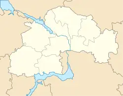
 Karpivka Location of Karpivka in Dnipropetrovsk Oblast#Ukraine  Karpivka Karpivka (Ukraine) | |
| Coordinates: 47°39′57″N 33°07′14″E / 47.66583°N 33.12056°E | |
| Country | Ukraine |
| Oblast | Dnipropetrovsk Oblast |
| Raion | Kryvyi Rih Raion |
| Elevation | 95 m (312 ft) |
| Population (2001) | |
| • Total | 836 |
| Time zone | UTC+2 (EET) |
| Postal index | 53742 |
| Area code | +380-5657 |
Karpivka (Ukrainian: Карпівка) is a village in the Kryvyi Rih Raion of Dnipropetrovsk Oblast (region), Ukraine. It hosts the administration of Karpivka rural hromada, one of the hromadas of Ukraine.[2]
Until 18 July 2020, Karpivka belonged to Shyroke Raion. The raion was abolished in July 2020 as part of the administrative reform of Ukraine, which reduced the number of raions of Dnipropetrovsk Oblast to seven. The area of Shyroke Raion was merged into Kryvyi Rih Raion.[3][4]
Demographics
According to the 1989 census of the Ukrainian SSR, the population of the village was 752, of which 367 were men and 385 were women.[5]
According to the 2001 census of Ukraine, 836 people lived in the village.[6]
Language
Distribution of the population by native language according to the 2001 census:[7]
| Language | Percentage |
|---|---|
| Ukrainian | 93.40 % |
| Russian | 4.43 % |
| Gagauz | 0.48 % |
| Moldovan (Romanian) | 0.48 % |
| Belarusian | 0.24 % |
| Others | 0.47 % |
Notable people
- Pavlo Lazarenko (born 1953), politician, Prime Minister of Ukraine from 1996 to 1997
References
- ↑ "Karpivka (Dnipropetrovsk Oblast)". weather.in.ua. Retrieved 13 August 2023.
- ↑ "Карповская громада" (in Russian). Портал об'єднаних громад України.
- ↑ "Про утворення та ліквідацію районів. Постанова Верховної Ради України № 807-ІХ". Голос України (in Ukrainian). 18 July 2020. Retrieved 3 October 2020.
- ↑ "Нові райони: карти + склад" (in Ukrainian). Міністерство розвитку громад та територій України.
- ↑ "Кількість наявного та постійного населення по кожному сільському населеному пункту, Дніпропетровська область (осіб) - Регіон, Рік, Категорія населення , Стать (1989(12.01))". database.ukrcensus.gov.ua. Archived from the original on 31 July 2014. Retrieved 7 November 2019.
- ↑ "Кількість наявного населення по кожному сільському населеному пункту, Дніпропетровська область (осіб) - Регіон , Рік (2001(05.12))". database.ukrcensus.gov.ua. Archived from the original on 31 July 2014. Retrieved 7 November 2019.
- ↑ "Розподіл населення за рідною мовою, Дніпропетровська область (у % до загальної чисельності населення) - Регіон, Рік , Вказали у якості рідної мову (2001(05.12))". database.ukrcensus.gov.ua. Archived from the original on 31 July 2014. Retrieved 7 November 2019.